How to drive the unpaved road to Hatun K'irawniyuq in Arequipa?
Hatun K'irawniyuq is a high mountain pass at an elevation of 4,407m (14,458ft) above sea level, located in the Arequipa Region of Peru. The road to the summit is the AR-105, an unpaved road that crosses the Andean range through a volcanic and arid landscape.
How long is the road AR-105 to Hatun K'irawniyuq?
The road through the pass is 30 km long, running from Arma to the junction with the AR-107.
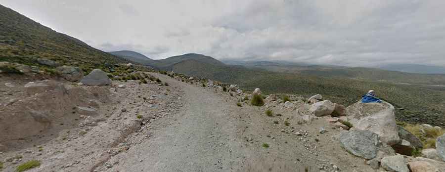
Is the road AR-105 to Hatun K'irawniyuq unpaved?
The road is totally unpaved, composed of fine volcanic dust and loose scree, with jagged rocks scattered across the track. Deep ruts and inconsistent traction make a high-clearance 4x4 required; standard vehicles will likely bottom out or get stuck in the soft volcanic sand sections.
How challenging is the road AR-105 to Hatun K'irawniyuq?
The road is narrow and sits on the edge of unprotected drops with no safety barriers. It features 10 sharp hairpin turns. Rockfalls are frequent, and the track can be blocked by debris at any moment. There is no cell service, fuel, or water for the entire stretch.
Is the AR-105 open year-round?
Set high in the Andes, it is subject to immediate closures. During the rainy season (December to March), flash floods often wash out sections of the AR-105, and mudslides are common. In the dry season (May to September), high winds create dust storms that reduce visibility to zero, hiding the edges of the shelf road. Sudden snowstorms can hit the summit even in summer.