How to drive the narrow 8B road through Calla Calla Pass?
The Calla Calla Pass is a high mountain crossing in the northern Peruvian Andes. At 3,600m (11,811ft), the 8B road connects Leimebamba and Balsas over an 88 km stretch. Driving here means dealing with a paved surface that is extremely narrow and in poor condition. The route moves from high-altitude peaks down to the humid forest, which means the road grip and visibility can change from one turn to the next.
| Road facts: Calla Calla Pass (8B) | |
|---|---|
| Location | Amazonas Department, Peru |
| Length | 88 km (Leimebamba to Balsas) |
| Max Elevation | 3,600m (Calla Calla) / 2,804m (Abra Chanchillo) |
| Surface | Paved (Narrow / Potholes) |
| Vehicle Requirement | Any (High-clearance recommended) |
What is the road condition on the 8B through Calla Calla?
The 8B road is paved but very narrow. In many sections, there isn't enough room for two large vehicles to pass at the same time. The road has hundreds of curves and tight hairpins with no guardrails. The drops into the canyon are deep and vertical. You have to drive slowly and be ready to backup to a wider spot if you meet a bus or a truck coming the other way. The pavement is often broken with potholes, so you need to keep an eye on the ground to avoid tire damage.
How to handle the descent from 3,600 meters?
The 88 km trip has a massive elevation drop. You go from 3,600 meters at Mirador Calla Calla down to the canyon floor. This puts a lot of stress on your brakes. You must use engine braking and stay in a low gear to avoid overheating the brake pads. If you are on a motorcycle, the temperature will drop fast at the top, so you need cold-weather gear even if it's hot at the bottom. The road also crosses Abra Chanchillo at 2,804 meters, so you have multiple climbs and descents to manage.
What are the main hazards on the Calla Calla Pass?
Visibility is a major problem at Calla Calla. Heavy mist and low clouds often cover the pass, making it hard to see the edge of the road. During the rainy season, rocks and mud fall onto the track, making the narrow road even tighter. There are almost no gas stations or shops between Leimebamba and Balsas, so check your fuel and tires before starting. The air is thin at the top, so your engine will have less power. If you start feeling dizzy or get a headache from the altitude, stop and let someone else drive or head to a lower elevation immediately.
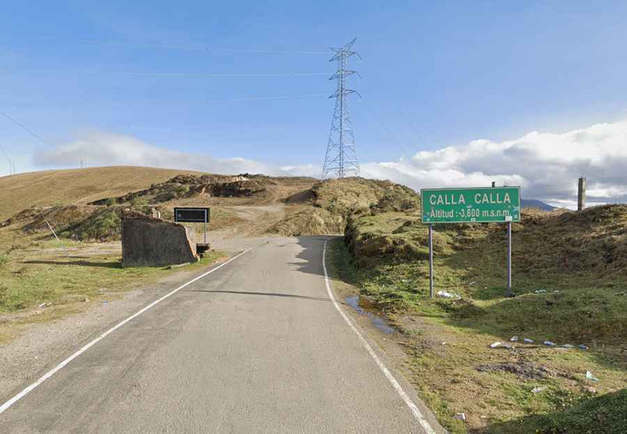
Stopping at the Calla Calla viewpoint
The Mirador Calla Calla is the highest point on the route. It’s a good place to stop and check your vehicle's fluids and brakes before starting the long descent. From here, you can see the layout of the canyon and the road ahead. Use this stop to secure any loose gear in your vehicle, as the hundreds of turns that follow will cause everything to move around. After this point, the road stays very narrow until you reach the town of Balsas at the bottom of the valley.