How to drive the Carretera 5N from Oxapampa to Nuevo Trujillo?
Located in central Peru, Carretera 5N is a high-risk mountain road connecting the Pasco and Huánuco regions. The route runs for 202 km (125 miles), starting in Oxapampa—a town known for its unique German-Austrian architecture—and ending in Nuevo Trujillo. The road follows deep canyons and crosses extreme terrain on the eastern slopes of the Andes.
| Road facts: Carretera 5N | |
|---|---|
| Location | Pasco and Huánuco regions, Peru |
| Length | 202 km (125 miles) |
| Hazard Level | Extreme (Landslides & Vertical Drops) |
| Surface | Partially paved / Dirt |
Is Carretera 5N from Oxapampa to Nuevo Trujillo dangerous?
The road is extremely narrow and runs along the edge of deep canyons. In several sections, the vertical drop to the river below exceeds 300 meters. There are no guardrails or safety barriers to protect vehicles from the edge. Along the route, numerous small boxes with crosses are visible, placed to commemorate victims of fatal accidents on this road. The area is also prone to severe landslides, especially during the rainy season, which can block the path for days.
What are the road conditions on Carretera 5N?
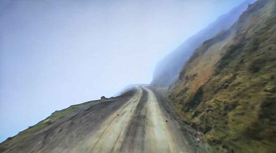
In recent years, the government has started improving the infrastructure. Portions of the route are now paved, but the road remains very narrow with no shoulder. Even on the asphalt sections, the risk remains high due to the lack of protection and the constant threat of falling rocks. The unpaved segments consist of loose gravel and mud, requiring a 4x4 vehicle for safe passage.
Geographic transition and culture
The journey starts in Oxapampa, located in the high jungle (Selva Alta). This town stands out for its European-style wooden architecture, brought by settlers from Germany and Austria in the mid-19th century. From there, the road heads north into the rugged territory of the Huánuco Region, following the Huancabamba river basin. The humidity and thick fog often reduce visibility to a few meters.
Technical driving tips for Carretera 5N
- Vehicle: A 4WD vehicle with high clearance is recommended due to mud and unpaved sections.
- Visibility: Use fog lights; visibility drops significantly in the canyon areas.
- Right of Way: On narrow sections, the vehicle climbing uphill usually has the right of way. Be prepared to reverse to a wider point.
- Weather: Check local reports before departure; landslide risk is extreme from December to March.