How to drive the challenging Carretera 104 from Jauja to San Ramon?
Located in the Junín Region of Peru, Carretera 104 is a high-mountain road. Set on the eastern slopes of the Andean Cordillera Oriental, the route connects the city of Jauja with San Ramón. It is a hazardous link between the high Andes and the Chanchamayo Province.
| Road facts: Carretera 104 | |
|---|---|
| Location | Junín Region, Peru |
| Max Elevation | 4,428m (14,527ft) |
| Length | 123 km (76 miles) |
| Surface | Unpaved |
Is Carretera 104 from Jauja to San Ramón unpaved?
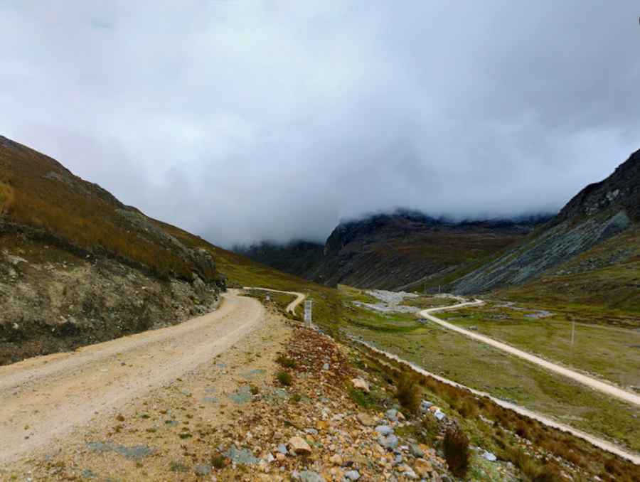
The road is totally unpaved and narrow. It comprises steep sections and hundreds of curves, including numerous hairpin turns. The track reaches its highest point at 4,428m (14,527ft) above sea level near Laguna Corazon (-11.658417, -75.382250). At this altitude, vehicle engine power is significantly reduced due to low oxygen levels.
How long is Carretera 104?
The road is 123 km (76 miles) long, running south-north from Jauja to San Ramón. The route provides views of lagoons and waterfalls but lacks guardrails and safety barriers. A 4x4 vehicle is required, especially during or after rain when the surface becomes muddy and unstable. Landslides are a frequent hazard on this section of the Andean slopes.
What are the hazards on the descent to San Ramón?
The road drops over 3,600 meters from the high peaks down to the jungle. As you get closer to San Ramón, the air becomes very humid and the terrain turns green. In this area, thick fog is common and some waterfalls fall directly onto the road. The mud makes the steep downhill sections very slippery.
Technical driving tips for Carretera 104
- Vehicle: High-clearance 4WD is mandatory.
- Brakes: Use low gears during the long descent to San Ramón to prevent brake overheating.
- Weather: Avoid travel during the rainy season due to extreme landslide risk.
- Logistics: No fuel or services are available for 123 km; carry full supplies from Jauja.
Pic: Steev Espinoza Zacarías