Laguna Capalococha: The ultimate 4x4 challenge in the Cordillera Blanca
Laguna Capalococha is a remote high-mountain lagoon situated at an elevation of 4,623m (15,167ft) above sea level in the Huaylas Province of Peru. Nestled deep within the Ancash Region, the road to this glacial lake is one of the most secluded and demanding tracks in the Cordillera Blanca range.
| Road facts: Laguna Capalococha | |
|---|---|
| Location | Huaylas, Ancash, Peru (Cordillera Blanca) |
| Max Elevation | 4,623 m (15,167 ft) |
| Length | 25 km (16 miles) |
| Hairpin Turns | ~30 |
| Surface | Wild Unpaved / Loose Rocks |
How to reach Laguna Capalococha?
The road to the lagoon spans 25 km (16 miles) and runs north-south, connecting the high mountain pass of Chicarhuapunta (4,289m) with the remote village of Purhuash. This route is rarely mentioned in travel guides, making it a true hidden gem for those exploring the western part of the Peruvian Andes.
Is the road to Laguna Capalococha dangerous?
Yes, this is an extremely challenging drive. The surface is unpaved and consists of loose rocks and gravel, with absolutely no guardrails protecting drivers from the dangerous vertical drops. The track features approximately 30 sharp hairpin turns that negotiate the steep Andean slopes. Due to the technical nature of the terrain and the altitude, a high-clearance 4x4 vehicle is highly recommended.
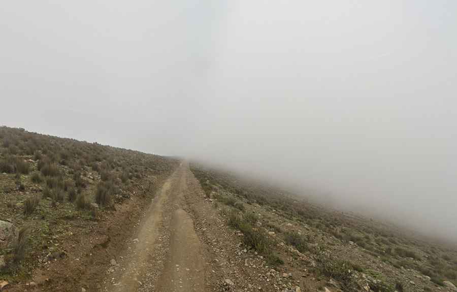
What are the weather conditions like?
At over 4,600 meters, the weather is a constant factor. The area is frequently shrouded in dense fog, which can reduce visibility to near zero in seconds. Combined with the narrowness of the track and the loose surface, driving here requires maximum concentration and experience in high-altitude environments. It is one of the most "raw" and "wild" driving experiences remaining in the Cordillera Blanca.