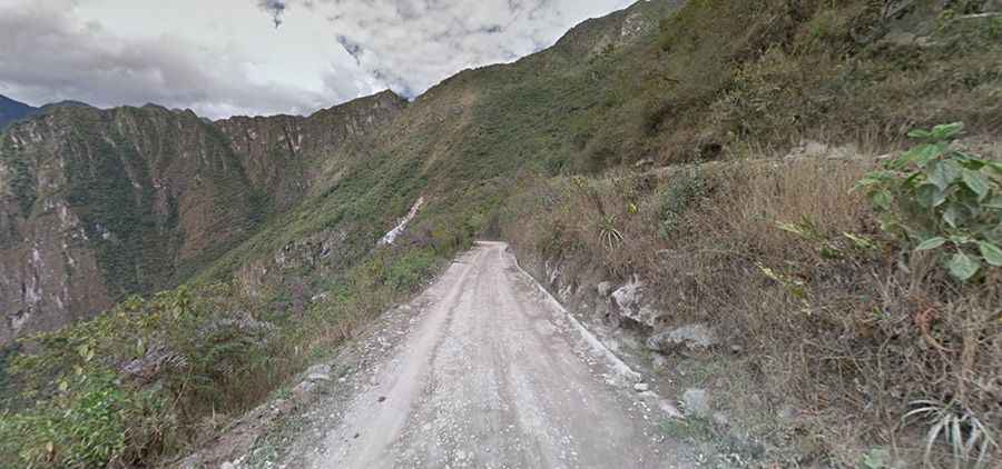
The road to Machu Picchu is pure adventure
Machu Picchu is a 15th-century Inca site at an elevation of 2,430m (7,970ft) above sea level, located in the Urubamba Province of Peru.
Can you drive to Machu Picchu?
The road to the historic sanctuary of Machu Picchu is totally unpaved. It’s called Carretera a Machu Picchu, also known as Hiram Bingham Highway. The zigzag road, which carries tourist buses to the site from the Urubamba River, is only authorized for allowed vehicles.
When was the road to Machu Picchu built?
The road was inaugurated in October 1948, and today it is nearing the risk of collapse due to deterioration. In January 2014, a landslide knocked out several of the road’s switchback corners for several days, forcing thousands of visitors to make the 45-minute trek on foot up to the iconic mountaintop ruins.
Why is the road to Machu Picchu called Hiram Bingham Highway?
The road is dedicated to Hiram Bingham (November 19, 1875 – June 6, 1956), who was a Hawaiian-born American academic, explorer, treasure hunter, and politician.
How long is the road to Machu Picchu?
Set high in the Eastern Cordillera of Peru, the road is 8.9km (5.53 miles) long, starting at Aguas Calientes (Spanish for "hot water" or "hot springs"), sometimes referred to as Machupicchu Town. There are many hotels and restaurants for tourists, as well as natural hot baths, which give the town its name. The baths were destroyed by floods many years ago but have been rebuilt.
Is the road to Machu Picchu challenging?
Tucked away on the southern part of the country, calling this serpentine road a ‘highway’ is a euphemism. The road is pretty challenging, made up entirely of 14 switchbacks, very narrow and steep, hitting a 27% maximum gradient through some of the ramps. Not for the faint of heart. At some points, when two buses meet, they have to stop and reverse partway up the hill (on the ‘outside lane’) to get to a spot wide enough for the two buses to pass (barely) one another. The hairy road will make you give a sigh of relief for having survived the drive when you get to the road end. On its route, it crosses a bridge over the Vilcanota River.