Nevado Huayracancha: Driving to 5,045m through the Peruvian mining heartland
Nevado Huayracancha (also spelled Wayrakancha) is a high mountain pass in the Peruvian Andes at an elevation of 5,045m (16,551ft) above sea level. Located on the regional border between Lima and Junin, this route is one of the highest roads in the country.
| Road facts: Nevado Huayracancha | |
|---|---|
| Location | Lima - Junin Border, Peru |
| Elevation | 5,045 m (16,551 ft) |
| Length | 28.7 km (17.8 miles) |
| Road Surface | Mostly Unpaved |
| Hazard Level | High (Mining Traffic & Altitude) |
Where does the road to Nevado Huayracancha start and end?
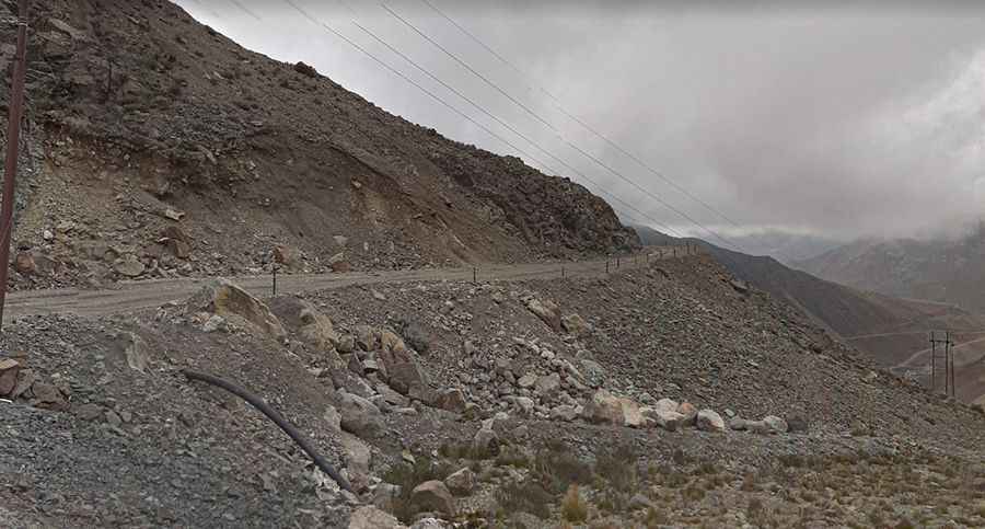
The pass is 28.7 km (17.83 miles) long, running west to east from the mining town of Casapalca to the settlement of Victoria. This route cuts through the heart of the Andes, offering breathtaking vistas of high-altitude lagoons like Pumatared and Pumacocha.
Is the road to Nevado Huayracancha unpaved?
The road is mostly unpaved, consisting of a mix of gravel and compacted dirt. While it is navigable by most passenger vehicles during good weather, the real challenge is the traffic. This pass is heavily used by massive mining trucks and coaches transporting workers. These heavy vehicles often take up the entire width of the road in the steeper sections, forcing smaller cars to maneuver near the edge.
What are the weather conditions like at the pass?
The weather at Huayracancha is unpredictable and often extreme. The surface can deteriorate quickly after rain or snow, creating deep ruts that can be difficult for vehicles without decent ground clearance. Even in the middle of summer, sudden snowfalls can occur, turning the dirt track into a slippery and dangerous trap. High winds are a permanent feature of the Cordillera Central, and temperatures can plummet well below freezing as soon as the sun is obscured. Because the road is so high, it is subject to frequent closures when snow accumulation becomes too deep for the mining crews to clear quickly.
Pic: david jayo