A Wild Unpaved Road to Pico de las Antenas
Pico de las Antenas is a high mountain peak at an elevation of 4,350 m (14,271 ft) above sea level, located in Ecuador. It’s one of the highest roads in the country.
Why is it called Pico de las Antenas?
The peak is called Pico de las Antenas (“Antenas Peak”) due to an array of telecommunication antennas and towers at the summit, commonly known as Papallacta Antennas.
Where is Pico de las Antenas?
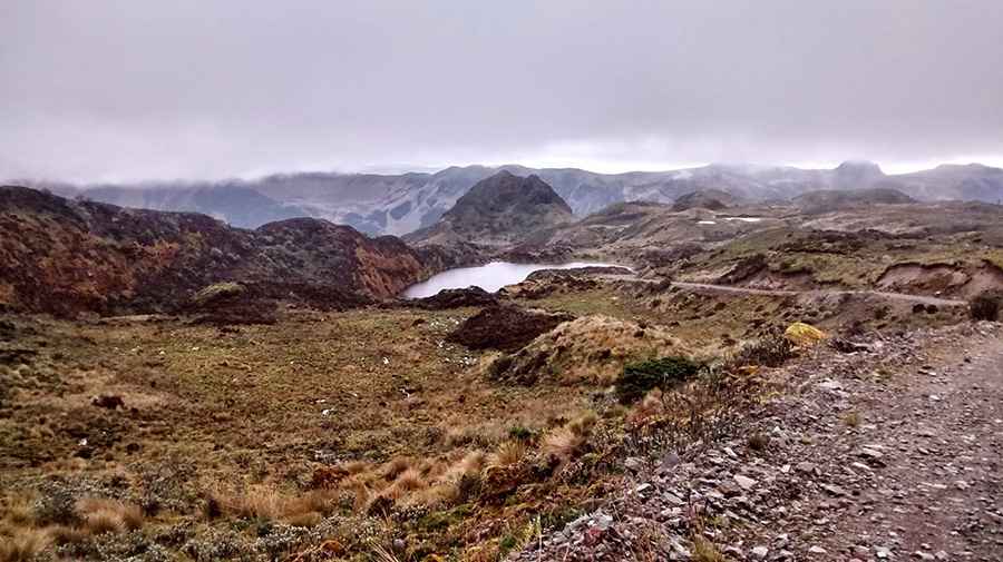
The peak is located east of Quito, on the boundary of Pichincha and Napo Provinces, in the north-central part of the country, within the Parque Nacional Cayambe Coca.
Is the road to Pico de las Antenas unpaved?
The road to the summit is totally unpaved and challenging, with big rocks, sharp turns, steep parts, and narrow sections. A 4x4 vehicle is required. If you go, be prepared for very high elevation conditions.
How long is the road to Pico de las Antenas?
Set high in the Andes just off the Eastern Cordilleras, the road to the summit is 3.5 km (2.17 miles) long starting from La Virgen Pass. Over this distance, the elevation gain is 276 m and the average gradient is 7.88%.
Pic: Jesus Ramos Martin