The road to Cotopaxi Refuge is not for timid drivers
Refugio José Rivas is a high mountain refuge on Cotopaxi volcano, at an elevation of 4,639m (15,219ft) above sea level, located on the boundary between Pichincha and Cotopaxi provinces of Ecuador. It's one of the highest roads in the country.
Can you drive to Refugio José Rivas?
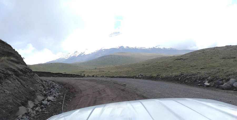
Located about 50 km (31 mi) south of Quito, in the Andes Mountains, the road to the hut, locally known as Refugio Cotopaxi, is totally unpaved. It’s called Subida Parqueadero Refugio Cotopaxi. It’s a bumpy gravel road that has been eroded by rainstorms. It’s dusty in dry weather and muddy in wet. The road ends in the parking lot for the refuge.
Is the road to Refugio José Rivas worth it?
Set high on the northern flanks of Volcán Cotopaxi, the second-highest volcano in Ecuador, within Cotopaxi National Park, the refuge has a capacity for 86 people. It was built in 1971 and extended in 2005. It is owned and operated by Grupo Ascensionismo del Colegio San Gabriel. On a sunny day, you’ll get magnificent views of the peak and its famous conical shape. The hut used to be an overnight destination for mountaineering teams acclimatizing before making an ascent on the peak. Since 1738, records show Cotopaxi has exploded more than 50 times. It’s said to be the highest active volcano in the world. Be prepared for high-altitude sickness.
Is the road to Refugio José Rivas difficult?
The drive is not for the faint of heart. Weather conditions can pose a problem with bad weather conditions, wind, and thunderstorms. Make sure the gas tank is full. You’ll need a 4WD high-clearance vehicle. Your vehicle needs to be in good shape and prepared for a lag in power. At this altitude, the thin atmosphere can affect the car’s engine and decrease acceleration or climbing power.
Is the road to Refugio José Rivas steep?
The remote and exposed road to the refuge is very steep, hitting a 14% maximum gradient through some of the ramps. Starting at Ovejería, the ascent is 8.2 km (5.09 miles) long. Over this distance, the elevation gain is 763 meters. The average gradient is 9.30%.
Pic: Walter Lara