How to drive the steep 4x4 road to Alto de Salinas in Ecuador?
Alto de Salinas is a high mountain pass at an elevation of 4,344m (14,251ft) above sea level, located in the Bolívar province of central Ecuador. Ranking as one of the highest roads in the country, it offers a dramatic ascent into the heart of the Andean paramo.
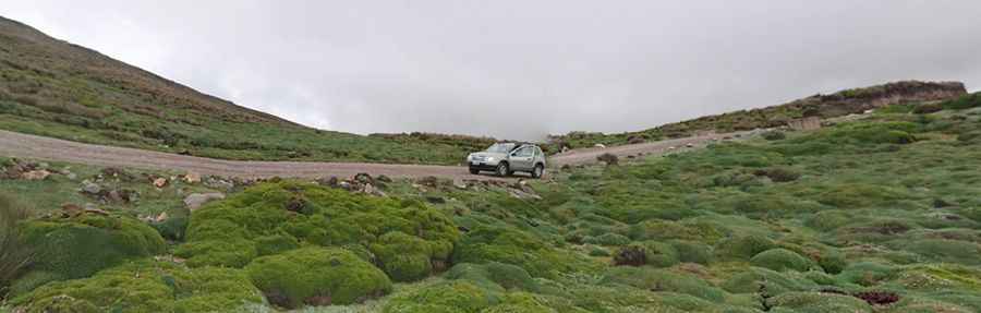
The road is a vital high-altitude corridor that connects the unique community of Salinas de Guaranda (also known as Salinas de Tomabela) with the higher alpine plateaus. This region is famous for its high-altitude grasslands and unpredictable weather, where the landscape is often shrouded in thick mist. Driving this route provides a raw look at the volcanic terrain of the Andes, far from the typical tourist paths of the Pan-American Highway.
| Road facts: Alto de Salinas | |
|---|---|
| Location | Bolívar Province, Ecuador |
| Elevation | 4,344 m (14,251 ft) |
| Length | 16.6 km (10.31 miles) |
| Max Gradient | 18% |
| Surface | Unpaved / Gravel |
Is the road to Alto de Salinas difficult to drive?
The journey to the summit is a true off-road challenge. Spanning 16.6 km (10.31 miles), the road runs west-east from the famous salt-producing village of Salinas de Guaranda towards the 491 Road. The track is totally unpaved and consists of loose gravel and dirt. It is a notoriously steep drive, with some ramps hitting a staggering 18% gradient. Due to the high altitude and the technical nature of the climb, a 4x4 vehicle is highly recommended to ensure enough traction and power on the steepest sections.
What are the weather conditions like at Alto de Salinas?
Tucked away in the high Andes, the weather at Alto de Salinas is notoriously unstable. Drivers should expect foggy, rainy, and misty conditions even during the dry season. The temperature drops significantly as you approach the 4,300-meter mark, often hovering near freezing levels. The combination of high altitude, steep inclines, and low visibility makes this one of the most demanding drives in central Ecuador. Travelers are advised to be well-prepared for the "paramo" climate and to check local conditions, as heavy rains can quickly turn the unpaved surface into a muddy and slippery track.
Pic: Daniel Alejandro Arroyo