How to drive the 4x4 road to Pico de las Antenas?
Pico de las Antenas is a high mountain peak at an elevation of 4,350m (14,271ft) above sea level located in Ecuador, in the Cayambe-Coca National Park. It is one of the highest roads in Ecuador.
How long is the road to Pico de las Antenas?
The climb starts at La Virgen Pass and runs for 3.5 km to the telecommunication towers at the summit. Over this distance, the elevation gain is 276m and the average gradient is 7.88%.
Is the road to Pico de las Antenas unpaved?
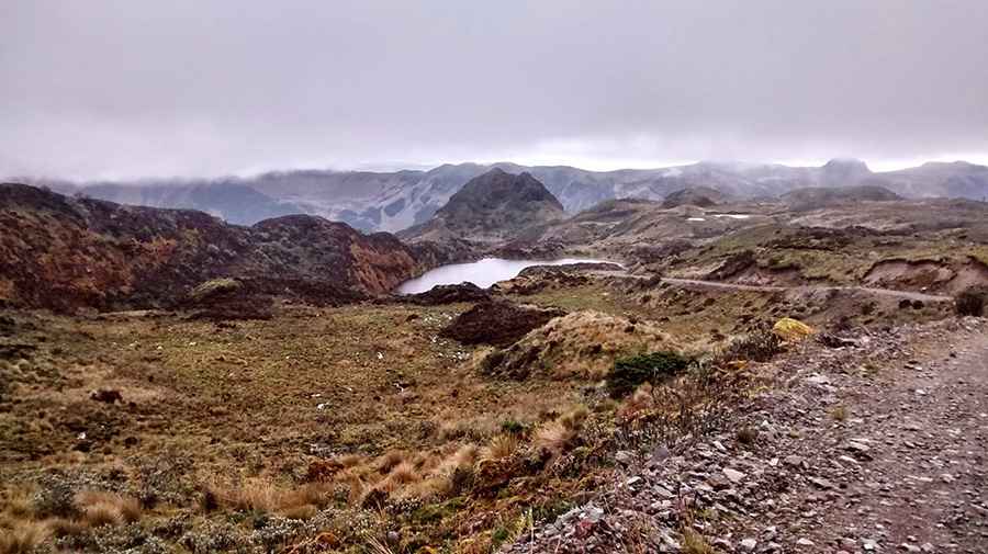
The road is entirely unpaved, with jagged volcanic rocks and deep ruts. A high-clearance 4x4 is required. The track is narrow and completely unprotected, with zero guardrails.
Can I drive to Pico de las Antenas year-round?
Access depends on the moisture levels of the Cayambe-Coca National Park. Rain turns the dirt sections into a thick mud bog, making the 7.88% slopes impassable for anything other than heavy-duty 4x4s with specialized tires. Visibility often drops to zero due to the dense "páramo" fog and sudden snowstorms that can hit the peak even in summer.
How remote is the road to Pico de las Antenas?
There are no services, no fuel, and no cell coverage at the summit. You must be self-sufficient and carry basic recovery gear, as the altitude can cause rapid lightheadedness and slow reaction times behind the wheel.
Pic: Jesus Ramos Martin