What are the most spectacular roads in Ecuador?
Ecuador is located in the northwestern part of South America. The country hosts many of the most spectacular roads in the world, as the country has coastlines (along the Pacific Ocean), high mountains (the Andes Mountains), and challenging conditions in the Amazon rainforest. So, get ready to face some of the most challenging drives.
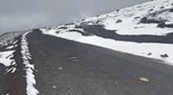
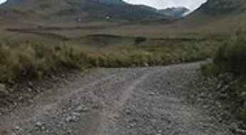
When travelling to the country, if you like unpaved mountain roads, try your luck climbing up to 2 mountain refuges: Cotopaxi Refuge, also known as Refugio José Rivas, sits at 4,639m (15,219ft) above sea level, on the boundary between Pichincha and Cotopaxi provinces. It's one of the highest roads in Ecuador. Or you can try the drive up to Edward Whymper Refuge, a high mountain hut at an elevation of 4.855m (15,928ft) above sea level.
Featuring 30 of the most spectacular roads in the world, it’s worth the drive through paved roads to Papallacta, the highest town in the country, situated at an elevation of 3,300m (10,827ft) above sea level. It’s one of the highest towns accessible by car on Earth. Or the climb up to Tres Cruces, a mountain pass at 4.161m (13,651ft) asl, in the province of Azuay.
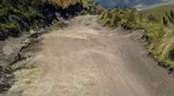
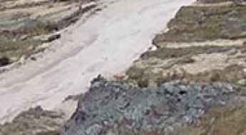
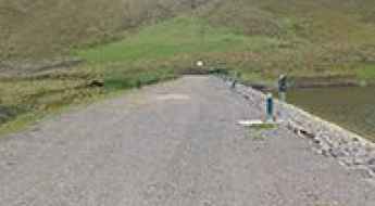
The road to Cotopaxi Refuge is not for timid drivers
Refugio José Rivas is a high mountain refuge on Cotopaxi volcano, at an elevation of 4,639m (15,219ft) above sea level, located on the boundary between Pichincha and Cotopaxi provinces of Ecuador. It's one of the highest roads in the country.
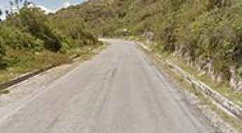
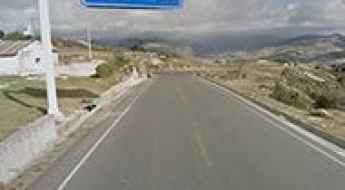
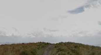
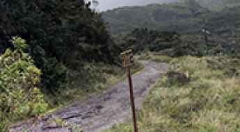
Papallacta is one of the highest towns accessible by car on Earth
Located in the Napo Province of Ecuador, Papallacta is the highest town in the country, situated at an elevation of 3,300m (10,827ft) above sea level. It’s one of the highest towns accessible by car on Earth.
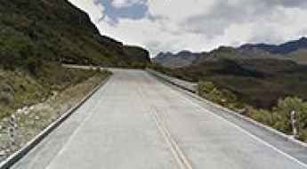
Travel guide to the top of Tres Cruces in Azuay
Tres Cruces is a high mountain pass at an elevation of 4.161m (13,651ft) above sea level, located in the province of Azuay, in Ecuador. It's one of the highest roads in the country.
The Wild Road to Edward Whymper Refuge
Refugio Edward Whymper is a high mountain hut at an elevation of 4,855m (15,928ft) above sea level, located in Chimborazo, a province in the central Ecuadorian Andes. It's one of the highest roads in the country.
Travel Guide to La Virgen Pass
La Virgen Pass is a high mountain pass at an elevation of 4,071 m (13,356 ft) above sea level, located in Ecuador.
How to get by car to the antennas at the Summit of Cerro Atacazo?
Cerro Atacazo is a stratovolcano at an elevation of 4.155m (13,631ft) above sea level located in Pichincha province, in Ecuador. It's one of the highest roads in the country.
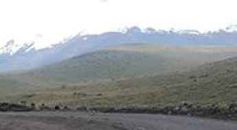
Laguna de Cuicocha
Laguna de Cuicocha is a crater lake at an elevation of 3.133m (10,278ft) above the sea level located in the Cordillera Occidental of the Ecuadorian Andes.
What are the highest roads of Ecuador?
Located on the northwestern coast of South America, bordered by Peru to the south and east, Colombia to the north and by the Pacific Ocean to the west, Ecuador is one of the smaller countries in South America. Roughly the size of the state of Colorado, Ecuador's geography is remarkably diverse, encompassing a wide range of natural formations and climates from the desert-like southern coast and the Amazon Basin plains to the snowcapped peaks of the Andes mountain range. The equator runs directly through the northern portion of the country.
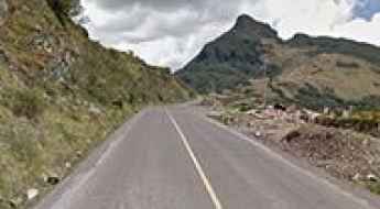
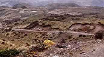
Driving the road to Corazon Volcano is not a piece of cake
Volcan Corazon is an ancient and extinct volcano located in the Pichincha province of Ecuador. A gravel road leads halfway up the mountain, ending at 4.306m (14,127ft) above the sea level. It's one of the highest roads of the country.
Driving the paved road to Laguna Quilotoa
Located in the Ecuadorian Andes, Quilotoa Lake is a high mountain lake at an elevation of 3.914m (12,841ft) above the sea level.
Mirador Via Principal
Mirador Via Principal Parque Nacional Cajas is a high mountain overlook at an elevation of 3.807m (12,490ft) above the sea level, located in southern Ecuador’s Andes mountains.
Pasochoa Volcano
Volcan Pasochoa is an extinct volcano at an elevation of 3.234m (10,610ft) above the sea level located in the Ecuadorian Andes.
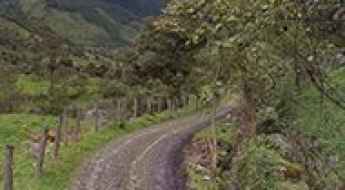
How to drive the cobbled road to Laguna Zorrocucho?
Laguna Zorrocucho is a high mountain lagoon at an elevation of 3.168m (10,393ft) above sea level, located in Azuay province, in Ecuador.
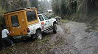
Driving the wild road to Refugio Volcán Guagua Pichincha
Refugio Volcán Guagua Pichincha is a high mountain refuge at an elevation of 4.557m (14,950ft) above the sea level, located in Pichincha province, in the country of Ecuador. It's one of the highest roads of the country.
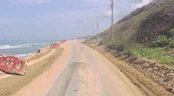
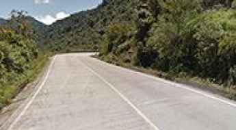
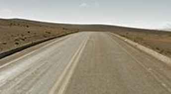
Discover Ecuador's 748-Kilometer Ruta Spondylus
The Ruta Spondylus is a long coastal road located on the Pacific shoreline of Ecuador. Designated as State Road E15, the asphalt track follows the western coast to connect the northern Colombian border with the southern peninsula.
A memorable road trip to Refugio Chiles
Refugio Chiles (Ángel Cerón) is an abandoned high mountain refuge at an elevation of 4.142m (13,589ft) above the sea level, located in the Carchi province.of Ecuador.
How to drive the steep 4x4 road to Alto de Salinas in Ecuador?
Alto de Salinas is a high mountain pass at an elevation of 4,344m (14,251ft) above sea level, located in the Bolívar province of central Ecuador. Ranking as one of the highest roads in the country, it offers a dramatic ascent into the heart of the Andean paramo.
Abra El Arenal: an epic road on a lunar landscape
Abra El Arenal is a high mountain pass at an elevation of 4.407m (14,458ft) above the sea level, on the boundary of Guaranda and San Juan, in Chimborazo Province of central Ecuador. It's one of the highest roads of the country.
A memorable road trip to Alto de Pasa
Alto de Pasa is a high mountain pass at an elevation of 4.123m (13,526ft) above the sea level, located in Tungurahua province, in Ecuador.
The road to Loma de las Antenas isn’t an easy one
Loma de las Antenas is a high mountain peak at an elevation of 4.218m (13,838ft) above sea level located in Pichincha province, in Ecuador. It's one of the highest roads of the country.
Abra de Zamora: enjoy a road among the clouds
Abra de Zamora is a high mountain pass at an elevation of 2.802m (9,192ft) above the sea level, located on the boundary of Zamora-Chinchipe and Loja provinces, in southern Ecuador.
Troncal Amazonica is most easterly main road of Ecuador
Troncal Amazónica is the easternmost major road in Ecuador. It's a scenic route that stretches almost the entire length of the country.
Road Trip Guide: Conquering Milagrosa Waterfall
Cascada Milagrosa is a high mountain waterfall at an elevation of 3,806m (12,486ft) above sea level, located in the Napo Province of Ecuador.
How to drive the 4x4 road to Pico de las Antenas?
Pico de las Antenas is a high mountain peak at an elevation of 4,350m (14,271ft) above sea level located in Ecuador, in the Cayambe-Coca National Park. It is one of the highest roads in Ecuador.