What are the most spectacular roads in Colombia?
Located in the northwest corner of South America, Colombia hosts many of the most spectacular roads in the world, as the country has coastlines (Pacific Ocean and the Caribbean Sea), high mountains (the Andes Mountains) and challenging conditions into the Amazon Basin.
When traveling to Colombia, if you like paved mountain challenges through awe-inspiring landscapes, don’t forget Alto de La Linea in the Andes, known as the Colombian Stelvio Pass. It’s a mountain pass at 3,271m (10,731ft) above sea level in the Andean Region. It’s also worth trying Trampolín del Diablo, a winding mountain road, or conquering the Alto de Letras, known as the world's longest road climb.
But if you prefer unpaved roads, you can’t miss Galeras Volcano in Pasto, a stratovolcano at 4,190m (13,746ft) above sea level. And don't forget it’s the country where you’ll find Darien Gap, a famous break in the Pan-American Highway.
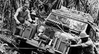
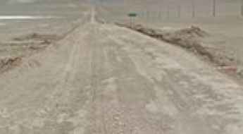
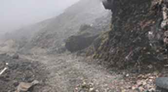
Darien Gap is a lethal break in the Pan-American Highway
Darien Gap is a break in the Pan-American Highway with a length of 60 miles (96 km) without roads, making overland travel across Central America nearly impossible. This gap, a near-impenetrable jungle that guerrilla fighters and drug runners call home, has been successfully crossed only a handful of times, usually by expeditions equipped with off-road vehicles and staffed by special forces types.
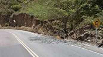
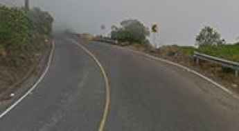
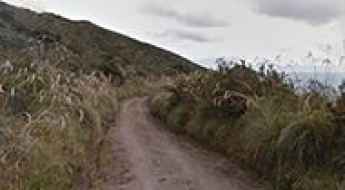
Trampolín del Diablo is a spooky road in the Andes
Located in the Putumayo Department of Colombia, the road from Mocoa to San Francisco is one of the most dangerous roads in the world. It was built in 1930 and zigzags through the Andean mountain range. There have been numerous deaths from cars falling off.
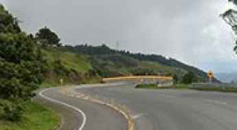
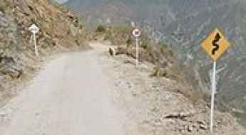
Alto de La Linea in the Andes is the Colombian Stelvio
Alto de La Línea is a high mountain pass at an elevation of 3,271m (10,731ft) above sea level, located in the Andean Region of Colombia.
Alto de Letras is the longest road climb in the world
Alto de Letras is a high mountain pass at an elevation of 3,692m (12,112ft) above sea level, located in the central part of Colombia. It’s one of the hardest and most epic climbs you can ride on two wheels.
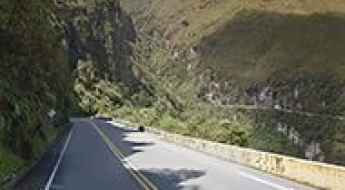
A hairpinned paved road across Chicamocha Canyon in Colombia
Cañón del Chicamocha is a steep sided canyon straddling the departments of Boyacá and Santander, in Colombia.
How to get by car to Nevado del Ruiz in Colombia?
Nevado del Ruiz is a glaciated stratovolcano with a conical shape, standing at an elevation of 5,321m (17,457ft) above sea level, located in Colombia. A sudden drop in temperature, even in summer, can trigger winter-like conditions. The drive to approach the volcano is said to be the highest road in the country.
How to get by car to Cerro Machin Volcano?
Cerro Machín is a stratovolcano at an elevation of 2,650m (8,694ft) above sea level, located in Tolima Department of Colombia.
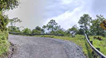
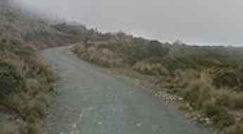
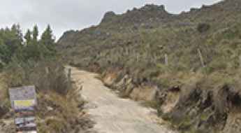
The unpaved road to Vetas, the highest town in Colombia
Located in Soto Norte Province, in the north-east of Santander department of Colombia, Vetas is said to be the highest town in the country, at an elevation of 3.350m (10,990ft) above sea level. It’s one of the highest towns accessible by car on Earth.
How to get by car to Tequendama Falls?
Located in the Department of Cundinamarca, in Colombia, Salto del Tequendama is a 132m high waterfall on the Bogotá River. It is one of the major tourist attractions in the country.
Road 37: A Dangerous Drive Due to Drug Cartel Fights in Colombia
Carretera 37 is a mountain road that runs through the Huila and Cauca departments of Colombia. The drive is extremely dangerous due to ongoing drug cartel violence in the area.
An unforgettable road to Nevado del Tolima
Nevado del Tolima is a stratovolcano located in Tolima Department, Colombia. A gravel road, south of the peak, tops out at 2,585m (8,480ft) above sea level.
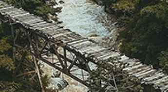
Crossing the old and precarious Puente Negro
Puente Negro (Black Bridge) is the name of a precarious bridge located in the department of Santander, in north-central Colombia. It’s one of the most spectacular bridges in the world.
Laguna Verde de Azufral: Driving the restricted emerald crater road of Colombia
Laguna Verde de Azufral is a stunning emerald-green volcanic lake sitting at an elevation of 3,970m (13,025ft) above sea level in the Nariño department of southern Colombia. Located within the Azufral Natural Reserve, the track leading to this dormant volcano's crater is one of the most beautiful yet challenging drives in the region.
Cepita Road
Located in Santander Department, in northeastern Colombia, the Carretera a Cepita is one of the most challenging roads of the country. Drivers must remain cautious as the pass has been known to claim the lives of careless drivers. Drive with care as this is a mountain road with hairpin curves and dangerous dropoffs.
Ruta Totoro-Inza
The Totoro-Inza is a high mountain road located in western Colombia. The drive is part of the Carretera 26.
Alto de la Cueva
Alto de la Cueva is a high mountain pass at an elevation of 3.855m (12,647ft) above the sea level, located in the Colombian Department of Boyacá, part of the sub-region of the Gutiérrez Province.
How to drive to Galeras Volcano in Pasto?
Volcán Galeras is a high mountain stratovolcano at an elevation of 4,190m (13,746ft) above sea level, located in the department of Nariño, in Colombia.
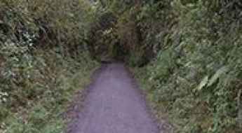
How to Travel the Challenging 4x4 Road to Lagunas Cunta
Lagunas Cunta refers to a series of five lagoons located in the Santurbán páramo, in the northeast of the Santander department in Colombia.