How to drive the volcanic tracks of Cerro Llullaillaco?
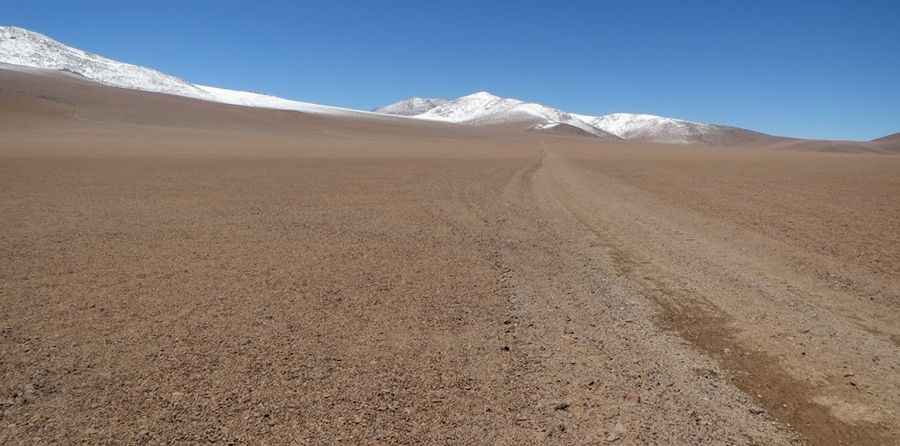
Cerro Llullaillaco is a dormant volcano situated on the international border between Argentina (Salta Province) and Chile (Antofagasta Region). A technical unpaved road on the southwest flank of the volcano reaches an elevation of 5,049m (16,564ft). This is a former mining track located in the heart of the Andes, characterized by extreme isolation and a surface composed of volcanic ash and sharp basalt rocks that test the limits of any off-road vehicle.
| Road facts: Cerro Llullaillaco | |
|---|---|
| Location | Argentina-Chile Border (Andes) |
| Max Elevation | 5,049m (16,564ft) |
| Surface | Unpaved (Volcanic rock/Scree) |
| Hazard Level | Extreme (Landmines & Navigation) |
| Vehicle Requirement | Modified 4x4 (Lockers & Skid plates) |
What are the navigation hazards on Cerro Llullaillaco?
The approach to Cerro Llullaillaco involves a complex network of poorly defined mining roads. Route-finding is notoriously difficult even with a GPS tracklog, as sandstorms and erosion frequently erase the tracks. A critical logistical hazard is the presence of landmines on the Chilean side of the border, remnants of past territorial disputes. It is a mandatory safety protocol to never leave the established tracks and to avoid driving off-road in the vicinity of the abandoned sulfur mines located to the north and south of the volcano. Driving alone in this sector is highly discouraged due to the total lack of rescue services.
What vehicle specs are needed for the Llullaillaco climb?
Stock vehicles are not capable of completing the 5,049m climb to the high camps of Llullaillaco. The terrain requires high-clearance 4x4s equipped with differential lockers and heavy-duty skid plates to protect the undercarriage from large, sharp volcanic rocks. The surface consists of loose scree and deep volcanic ash, which requires lowering tire pressure to gain traction. However, the sharpness of the basalt increases the risk of sidewall punctures, making it essential to carry at least two full-size spare tires and a high-lift jack. Turbocharged diesel engines are preferred here to compensate for the massive power loss caused by the thin air at 5,000 meters.
How to manage the high-altitude logistics on Llullaillaco?
Logistically, Cerro Llullaillaco is one of the most inaccessible points in the Puna region. The risk of Acute Mountain Sickness (AMS) is extreme due to the rapid ascent from lower altitudes. Drivers must monitor for symptoms like severe headaches or loss of coordination, as the technical maneuvering required through rock fields leaves no room for impaired judgment. Nighttime temperatures regularly drop well below freezing, even in summer, which can cause fuel gelling in diesel engines. Carrying supplemental oxygen, extra fuel for at least 500 km, and satellite communication equipment is the baseline for any transit in this sector.
What is the road condition near the Llullaillaco sulfur mines?
The tracks surrounding the Llullaillaco sulfur mines are largely unmaintained and subject to washouts. Steep, rocky ramps with high gradients require low-range gearing to manage both the climb and the descent. The abrasive nature of the volcanic soil accelerates tire wear and can damage air filters quickly; it is a technical requirement to check and clean filters frequently to prevent engine suffocation. Access is only possible during the dry season, as any snow or ice makes the steep volcanic slopes impassable even for modified 4x4 vehicles. Always verify border crossing permits, as this remains a sensitive military and geological zone.
Pic: Nicolás Lastra