Is the road to Cerro Azufrera de los Cuyanos the ultimate high-altitude test in Chile?
Cerro Azufrera de los Cuyanos is a massive volcano located in the Atacama Region of Chile, near the border with Argentina. The track leading to its slopes is one of the highest roads in the country, reaching a staggering elevation of 5,553m (18,218ft) above sea level. This extreme mine road is reserved only for the most experienced off-roaders and specialized vehicles.
| Road facts: Cerro Azufrera de los Cuyanos | |
|---|---|
| Location | Atacama Region, Chile (Near Argentina) |
| Length | 47.1 km (29.2 miles) |
| Max Elevation | 5,553 m (18,218 ft) |
| Elevation Gain | 2,060 m |
| Hairpin Turns | 13 (near the summit) |
| Surface | Rocky / Loose Gravel |
How to reach Cerro Azufrera de los Cuyanos by car?
The journey to the volcano begins from Ruta C-173. The road stretches for 47.1 km and involves a brutal elevation gain of 2,060 meters. Located south of Cerro Piedra Parada, the track climbs steadily through the desolate landscapes of the Atacama, ending at an altitude where oxygen is scarce and the environment is unforgiving.
What are the driving conditions on this Chilean volcano?
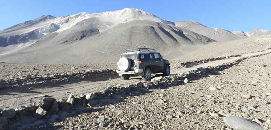
The road surface is primarily rocky and covered in loose gravel. Near the end of the climb, drivers must navigate 13 sharp hairpin turns that require tight maneuvering. The presence of large, sharp volcanic rocks significantly increases the likelihood of tire damage. Due to these extreme conditions, stock vehicles are not allowed; high clearance, skid plates, and differential lockers are mandatory requirements for this ascent.
What makes the Azufrera de los Cuyanos road dangerous?
Beyond the technical difficulty of the track, the altitude is the greatest hazard. At over 5,500 meters, thin air can cause severe respiratory problems or aggravate heart conditions. The area is also subject to brutally cold temperatures and high winds that blow all year long. Rapid weather changes are common, and it is possible to encounter heavy snow even during the summer months.
Is this a public road or a mine track?
The route to Cerro Azufrera de los Cuyanos is an old mine road. Its primitive state reflects its industrial past, and it remains largely unmaintained. Because of its extreme isolation and exposure to the elements, travelers must be fully prepared for emergencies, carrying extra fuel, oxygen, and cold-weather gear. There are no services or rescue teams nearby in this remote corner of the Atacama Region.
Pic: http://www.atacamarutas.cl/