How to drive the unpaved road to Portezuelo Maricunga in the Atacama Desert
Portezuelo Maricunga is a high mountain pass at an elevation of 4,133m (13,559ft) above sea level, located in the heart of northern Chile’s Atacama Desert.
Where is Portezuelo Maricunga?
Situated within the Atacama region, within Nevado Tres Cruces National Park, this pass is a gateway to some of the most dramatic and isolated landscapes in the High Andes.
How long is the road through Portezuelo Maricunga?
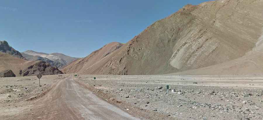
The road through the pass is called C-601. It’s 222 km long, running north-south from La Puerta (Copiapó, Atacama) to La Guardia (Tierra Amarilla, Atacama).
Is the road through Portezuelo Maricunga unpaved?
The road is totally unpaved, with loose gravel and deep sand. As you approach the highest point of the pass, the track becomes increasingly defiant, featuring 8 sharp hairpin turns that climb steeply. The sandy surface of Route C-601 can become extremely muddy and slippery after the rare desert rains, making it nearly impossible to maintain traction.
What’s the weather like at Portezuelo Maricunga?
The environment at Portezuelo Maricunga is one of extreme contrasts. Daytime temperatures can soar up to 30 °C, while at night, the mercury drops drastically, often falling well below freezing point during the winter months. The area is also notorious for its fierce, relentless winds that sweep across the salt flats and volcanic peaks of the Atacama. During and after a storm, the road can become completely impassable, even for the most capable four-wheel-drive vehicles.
How remote is the road through Portezuelo Maricunga?
Due to the extreme isolation of the area, drivers must be fully prepared for a self-sufficient journey, as there are no services or help for tens of miles in any direction. It is essential to carry extra fuel, plenty of water, and reliable satellite communication, as this is one of the most remote "high roads" in northern Chile.