Driving a 4x4 mine road to Acotango Volcano in the Andes
Volcán Acotango is a volcano located on the border of Bolivia and Chile. A 4x4 mining trail climbs up to 5,509m (18,074ft) above sea level near the summit. The track beyond this point continues further, but it is impassable. It is one of the highest roads in the country.
Where is Acotango Volcano?
The volcano is located in the Andes mountain range, within Sajama National Park. It’s the tallest volcano among the stratovolcanoes known as Nevados de Quimsachata, situated on the border of Bolivia and Chile,
Can I drive to Acotango Volcano?
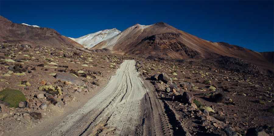
The route to the volcano is a mining road, completely unpaved. It starts from the Chachacomani-Tambo Quemado road in Departamento de Oruro, Bolivia. You can drive up to the base camp at 4,900 meters, and the road remains drivable until approximately 5,600 meters. This road leads to a sulphur mine on the mountain, where work is underway to establish some structures at this elevation. The road becomes very steep beyond 4,800 meters, but the surface remains in acceptable condition up to 5,250 meters, after which it deteriorates.
Is the road to Acotango Volcano open in winter?
The drive provides breathtaking views of the stunning landscapes of the Andean highlands. This trail is usually open only during the summer months. However, it may be subject to closures at any time due to potential avalanches and heavy snowfalls that can obstruct certain sections of the road. Climbing to the summit from the Chilean side is dangerous due to the presence of land mines. Ascending from the Bolivian side is comparatively safer. Conditions can change rapidly and become quite challenging. It’s one of the highest roads of South America.More pics&info: http://www.whileoutriding.com/south-america/bolivia/burial-chambers-frozen-potatoes