How to Drive the Road to Cerro Armazones in the Atacama Desert?
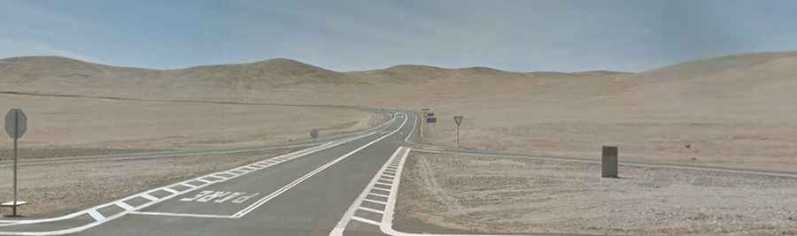
The road to Cerro Armazones is a high-altitude specialized access route located in the Antofagasta Region of northern Chile. Reaching an elevation of 3,060m (10,040ft) above sea level in the Atacama Desert, this asphalted track was engineered to facilitate the transit of massive structural components for the Extremely Large Telescope (ELT). Navigating this sector requires a vehicle prepared for extreme barometric pressure drops and sustained high-torque climbs in the driest environment on Earth.
| Road facts: Cerro Armazones | |
|---|---|
| Location | Atacama Desert, Chile (B-710 to B-750) |
| Length | 16.9 km (from B-750 junction) |
| Average Gradient | 4.23% (Max peaks exceed 10%) |
| Technical Surface | Reinforced Asphalt for Heavy Loads |
How is the road to Cerro Armazones engineered for heavy logistics?
The technical profile of the Cerro Armazones road was significantly upgraded to support the transport of over 2,500 tons of structural steel and high-precision mirrors. Starting from the paved B-750, the 16.9 km ascent involves a total elevation gain of 715 meters. The engineering required leveling the mountaintop into a stabilized plateau. Logistically, the road surface is treated to withstand the high axle loads of specialized heavy-haulage trailers. Drivers must account for the narrow radius of certain switchbacks, which were designed specifically for the turning circles of oversized transport convoys heading to the observatory site.
What are the atmospheric and mechanical hazards at Cerro Armazones?
Despite being in the driest desert on Earth, the high altitude of Cerro Armazones introduces severe meteorological risks. High-velocity winds are constant, frequently exceeding 100 km/h, which can affect the stability of high-profile vehicles. Logistically, the road can be closed without notice due to heavy mist (camanchaca) or sudden winter snowfalls that accumulate even in the summer months. Mechanically, the reduced oxygen levels at 3,060m cause a noticeable loss in engine power for naturally aspirated internal combustion engines. It is mandatory to verify cooling system efficiency, as the combination of steep grades and low air density reduces heat dissipation capacity.
Driving protocols: Altitude sickness and technical safety
Operating a vehicle on the Cerro Armazones route requires strict adherence to safety protocols. Altitude sickness (soroche) is a real risk for drivers ascending rapidly from the coast; maintaining hydration and recognizing early symptoms is essential for safe navigation. The road features steep sections where engine braking is mandatory to prevent brake fade during the descent. Visibility can drop to near-zero levels due to dust storms or fog, making it dangerous to operate without high-intensity fog lighting. In severe weather, the access is restricted by the European Southern Observatory (ESO) logistics team to ensure that the road remains clear for emergency transit.
Infrastructure and supply chain logistics in the Atacama
The logistics of reaching Cerro Armazones are governed by the isolation of the Atacama. There are zero refueling points or mechanical services along the B-710 or B-750. Any transit must be self-sufficient, carrying additional water, fuel, and survival gear for extreme sub-zero temperatures during winter nights. The road is a vital link for the international scientific community, and its maintenance is a priority for the ELT project. For technical drivers, this route represents one of the most stable but demanding asphalt climbs in the Chilean Andes, requiring a vehicle in top mechanical condition and a pilot experienced in high-altitude desert navigation.