Portezuelo de Guaitiquina: Driving the remote 4,288m border pass
Reaching an elevation of 4,288m (14,068ft) above sea level, Portezuelo de Guaitiquina is an international high mountain pass located on the stark border between Chile and Argentina. Far less traveled than the nearby Paso de Sico, this route offers a raw and isolated crossing through the high-altitude deserts of the Andes, connecting the Antofagasta Region with the Salta Province.
| Road facts: Portezuelo de Guaitiquina | |
|---|---|
| Location | Chile (Antofagasta) - Argentina (Salta) Border |
| Elevation | 4,288 m (14,068 ft) |
| Length | 58.1 km (36.1 miles) |
| Road Number | RP37 (Chile) / Unnamed (Argentina) |
| Vehicle Required | High-clearance 4x4 recommended |
Where is the Portezuelo de Guaitiquina pass?
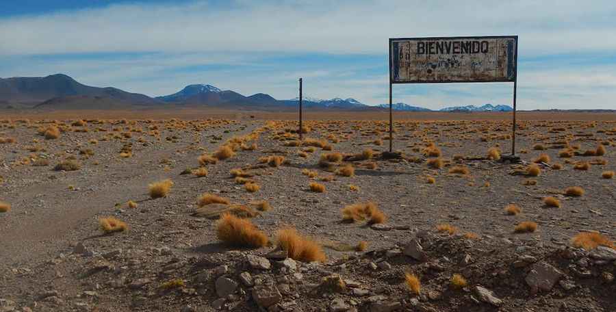
The pass links the San Pedro de Atacama province in northern Chile with the village of Catua in Argentina. The road spans 58.1 km (36.1 miles), running west to east from the B-357 junction in Chile to the Salta border. This is a high-desert corridor where the geography is dominated by salt flats, volcanic peaks, and vast horizons. Unlike the main commercial passes, Guaitiquina feels forgotten, with very little traffic and absolute silence once you leave the main transit routes.
Is the road to Portezuelo de Guaitiquina unpaved?
Yes, the road over the pass is entirely gravel. In Chile, it is designated as RP37, while on the Argentine side, it remains an unnamed track toward Catua. The climb is notorious for its high degree of steepness and a notorious lack of oxygen that will test your vehicle's cooling system and engine power. The surface can get very muddy and slippery after even a light rain, making the gravel ramps extremely challenging to navigate. While it is technically open to all motorized vehicles, a high-clearance 4WD is strongly recommended to handle the washboarding and the occasional sand drifts.
What are the hazards at Portezuelo de Guaitiquina?
The primary hazard is the extreme altitude of 4,288 meters. Most drivers begin to feel altitude sickness (soroche) as low as 2,500 meters, so crossing this pass requires proper acclimatization. However, there is a more hidden danger: landmines. Sections of the border area in the Atacama were mined in the late 1970s. While most areas near the main tracks have been cleared, there is still a high risk if you wander off the established road. It is essential to stay strictly on the gravel path and never venture into the open desert or unmarked side trails.
What are the border crossing hours at Guaitiquina?
If you intend to cross between Chile and Argentina here, keep in mind that the border is typically open from 8 am to 6 pm. However, due to its isolation, hours can change without notice depending on weather or staff availability. The climate is arid but can turn brutally cold in an instant. High winds are a constant factor, and the road can be blocked by snow or ice during the winter months. Always carry extra fuel, water, and cold-weather gear, as help is hours away and cell service is non-existent in this part of the Puna.
Pic: Juan Francisco Busto