How to get by car to Chungara Lake in Chile?
Lago Chungará is a high mountain lake at an elevation of 4,517m (14,820ft) above sea level, located in the Parinacota Province of the Arica and Parinacota Region in Chile. It’s the 10th highest lake in South America.
Where is Chungara Lake?
The lake is located in the highlands of the Andean Altiplano, in the extreme north of Chile, near the border with Bolivia, within the Arica y Parinacota Region in the Lauca National Park.
How is Chungara Lake?
The lake was formed between 8,000 and 17,000 years ago. It has a depth of 33 meters and it is surrounded by land and mountains that are home to alpacas, traucas, vizcachas, guanacos, vicuñas, pumas, llamas, and foxes.
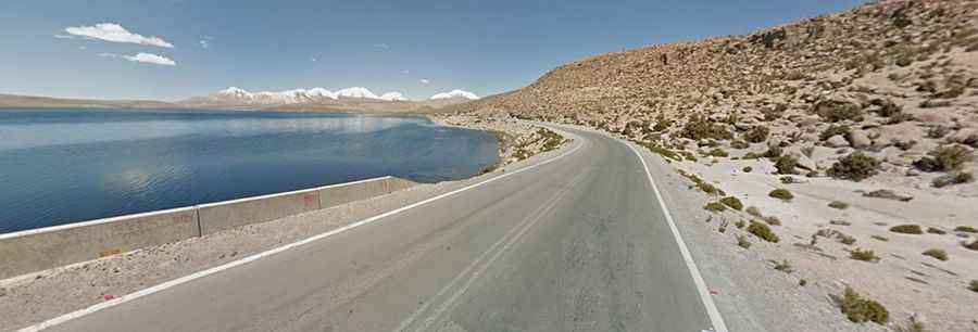
How long is the road to Chungara Lake?
The road to the lake is called Ruta (Carretera Internacional CH11) 11. It’s paved, with heavy traffic, especially trucks. It is 25km (15.53 miles) long, running west-east from Parinacota, one of the highest elevation human habitations in the world, in Putre, to Chungara-Tambo Quemado Pass.
Is the road to Chungara Lake challenging?
Remember, this is a mountainous area, climbing up a high mountain, with a notorious absence of oxygen. An engine check should be made to all carbureted motor vehicles prior to driving at altitude. If the engine loses power in heavy climbs, take off the air filter. There are no gas stations on the roads. For a trip to Lago Chungará, you must fill the tank completely in Arica. If you plan a larger trip, you must carry additional gasoline with you. Remember to take great photos of volcanoes reflected in the lake's surface. Altitude and extreme weather are always a factor.