Driving the road to Embalse El Yeso and Termas del Plomo
Embalse El Yeso is a turquoise reservoir at an elevation of 2,605m (8,546ft) above sea level, located in the Santiago Metropolitan Region of Chile. Situated in the heart of the Cajón del Maipo, this Andean dam is a primary water source for Santiago and offers a high-altitude driving experience through the rugged mountain landscape near the Argentinian border.
| Road facts: Embalse El Yeso | |
|---|---|
| Location | Cajón del Maipo, Chile |
| Elevation | 2,605 m (Embalse) - 2,976 m (Termas) |
| Length | 23 km from San Gabriel |
| Vehicle Required | High-clearance / 4x4 for Termas |
Where is Embalse El Yeso?
The reservoir is located to the west of Santiago, near the border with Argentina. The terrain is a high-altitude desert where the reservoir was created in 1964 by damming the Yeso River. At this altitude, there is no pollution, so the skies are a deep blue color. Its turquoise waters are used for fishing and windsurfing, though the primary purpose remains water storage for the metropolitan region.
Is the road to Embalse El Yeso unpaved?
The road to the reservoir, known as Camino Embalse El Yeso, is totally unpaved. While it is navigable by passenger vehicles in dry weather, a vehicle with high ground clearance is highly recommended. The surface is often uneven with loose rocks and potholes that can damage the undercarriage of low-profile cars.
Do you have to pay to access Embalse El Yeso?
Yes, there is now a controlled access point on the road to the reservoir. Local authorities have implemented a barrier system where visitors must pay an access fee (toll) to enter the area. This measure is used to control the number of vehicles at the summit and to manage the environmental impact on the Cajón del Maipo. Always carry local currency in cash, as there is no electronic payment system in this remote mountain sector.
How long is the road to Embalse El Yeso?
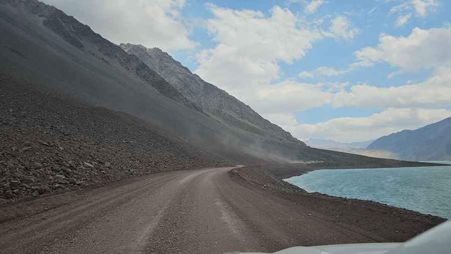
Starting at San Gabriel, the road to the dam is 23 km (14.29 miles) long. The drive involves a significant elevation gain of 1,300 meters with an average gradient of 5.65%. The route meanders along the edge of the hills on a path won from the mountain. The narrow nature of the track becomes apparent when you drive around a bend and come head-to-head with another vehicle on what is essentially a one-lane road with high drop-offs.
Does the road continue to Termas del Plomo?
Yes, the road continues past the eastern shore of the reservoir toward Termas del Plomo, located at an elevation of 2,976m (9,763ft). However, the technical difficulty increases drastically after the dam. While the road to the reservoir can be handled by most high cars, the stretch to Termas del Plomo is strictly for 4x4 vehicles. You will encounter deep ruts, river crossings, and very sharp rocks that will stop any standard passenger vehicle. This 10 km extension requires experienced off-road driving skills.
Is the road to Embalse El Yeso challenging?
The mountain road frequently verges on nerve-wracking, as the dramatic drops to the canyon floor below are unprotected. Visibility can be low, and the most challenging section runs along the southern shore of the reservoir where the track narrows significantly. It is advised not to drive this road alone in bad weather, as the dirt surface turns into a slick mud trap that makes steering difficult on the steep inclines.
Is the road to Embalse El Yeso open?
Set high in the Andes, accessibility is dictated by snowfall. Although a 4x4 might get you close to the western edge in winter, the road is often totally impassable during heavy snow. The weather can change rapidly, bringing the feared "White Wind" (Viento Blanco), a strong storm of wind, ice, and snow that can put your life in danger. Always check the forecast before heading past San Gabriel, as the isolation at 2,600 meters leaves no room for mechanical or weather-related errors.
Pic: Toni Hernandez