Driving Ruta 9 to Faro San Isidro, the Southernmost Lighthouse on the American Mainland
San Isidro Lighthouse is located in the XII Region of Magallanes and Chilean Antarctica, in southern Patagonia, Chile. It's the southernmost lighthouse on the mainland continent. Lit in 1904, it's part of a chain of eight century-old lighthouses placed along the shores of the Strait of Magellan.
Where is San Isidro Lighthouse?
Located at the southern end of the Brunswick Peninsula, on the shore of the Strait of Magellan, the lighthouse sits at the tip of South America. Don't forget your camera! Built in 1904 by George Slight, Cabo San Isidro is known for its mountain chains and wide diversity of species and habitats: subantarctic forests full of coigüe and cinnamon trees, peatlands, wetlands, highlands, glacier valleys, rivers, and lakes.
When was San Isidro Lighthouse built?
This lighthouse was built following a study carried out by George Slight, then Inspector General of Lighthouses, and by a Chilean contractor, Luis Camuzi. This location was chosen because it was the only site accessible for positioning at Cape Froward, where the Strait of Magellan twists, causing its waters to collide with the coasts of the city of Punta Arenas. The lighthouse stands 10 miles south of a historically significant point, where the first Spanish conquistador outposts were established during the 16th century in the Strait of Magellan. During their initial expeditions, they faced unfavorable outcomes. The first settlers who founded the small towns "Nombre de Jesús" and "Rey Don Felipe" perished from starvation and cold. This coastal location was named "Port of Hunger."
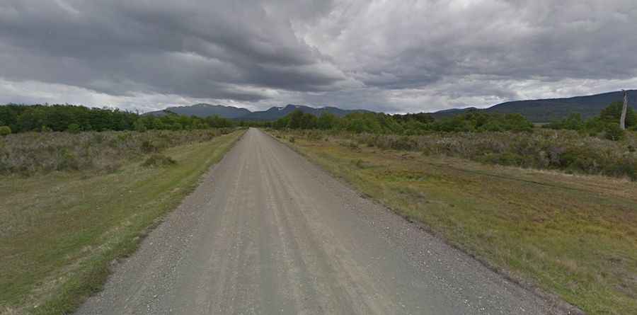
Can I drive to San Isidro Lighthouse?
The road leading to the lighthouse is very scenic and is named Ruta 9. It's unpaved but well-maintained, without any significant hazardous bends or drops.
How long is the road to San Isidro Lighthouse?
Starting from Ciudad del Rey Don Felipe, also known as Puerto del Hambre, a historic settlement site at Buena Bay, the road spans 23.6 km (14.66 miles). The final 7 km (4.34 miles) are not accessible to vehicles. The road concludes at a parking lot, marked by a "Fin de Camino" (End of the Road) sign. From there, visitors must walk to the lighthouse. The trail, established in the early twentieth century, winds along the coast, providing views of the Strait of Magellan. However, be prepared: the lighthouse, while picturesque, does not offer amenities like water, bathrooms, or even entry into the building, so plan accordingly.
Road suggested by: Francisco Toro