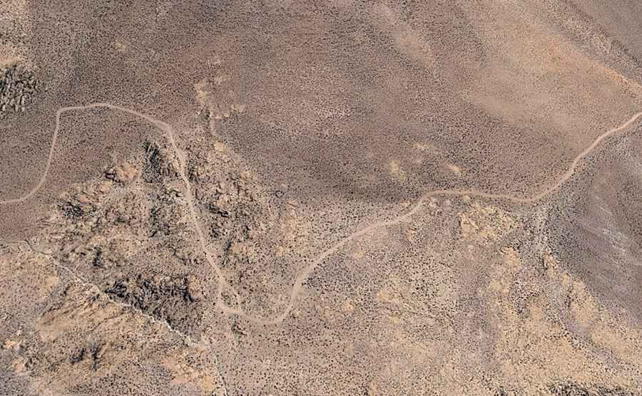
How to drive the 49 km unpaved track of Paso Iruputuncu?
Paso Iruputuncu is an international high mountain pass at an elevation of 4,070m (13,353ft) above sea level, located on the border between Bolivia and Chile. Situated just south of the active Irruputuncu volcano, the pass serves as a remote logistical link between the Tarapacá Region in Chile and the Daniel Campos Province in Bolivia. The 49.3 km route is entirely unpaved, narrow, and requires high-clearance 4x4 vehicles to manage the technical terrain and extreme altitude shifts of the Altiplano.
| Road facts: Paso Iruputuncu | |
|---|---|
| Location | Bolivia (Potosí) - Chile (Tarapacá) Border |
| Elevation | 4,070 m (13,353 ft) |
| Length | 49.3 km (30.6 miles) |
| Elevation Gain/Loss | +871 m / -1,074 m |
| Surface | Unpaved / Narrow track |
What are the technical driving challenges of the 49 km Iruputuncu route?
The 49.3 km transit between Collacagua and Vilasaca is a technical endurance test for any vehicle. Logistically, the road is characterized by being extremely narrow, with several sectors where passing oncoming traffic is impossible without complex reversing maneuvers. The surface consists of loose volcanic ash, sand, and sharp rocks. Technically, a 4x4 vehicle is mandatory to maintain traction on the +871 m and -1,074 m elevation changes. Drivers must account for the high rolling resistance of the uncompacted soil, which significantly increases fuel consumption compared to standard unpaved roads.
How does the proximity to Irruputuncu Volcano affect road logistics?
Driving south of the Irruputuncu volcano introduces specific geological hazards to the route. Technically, the road surface is prone to sudden changes due to volcanic debris and sulfur deposits that can corrode exposed metal components over time. Logistically, the area is highly isolated, with no mechanical or medical support for the entire 49.3 km stretch. Before attempting the transit, it is a mandatory protocol to check the vehicle's air filtration system, as fine volcanic dust can quickly clog standard filters, leading to engine oxygen starvation at an already critical elevation of 4,070 meters.
What are the mechanical and crew safety protocols for Paso Iruputuncu?
At an elevation of 4,070 meters, the risk of engine power loss and Altitude Mountain Sickness (AMS) is constant. Logistically, the crew must be prepared for extreme thermal inversion; temperatures can drop 20°C in a matter of minutes if the sun is obscured. Technically, the braking system requires a specific descent protocol for the -1,074 m sector towards Vilasaca; utilizing engine braking is essential to prevent the overheating of rotors on the narrow, winding track. Carrying a minimum of two full-size spare tires and extra fuel reserves (at least 20 liters) is a logistical necessity due to the abrasive nature of the volcanic terrain.
What is the seasonal operational status of the Iruputuncu pass?
While technically open, Paso Iruputuncu is subject to the unpredictable patterns of the "Altiplano Winter" (January-March) and heavy Andean snowfall (June-August). During these periods, the 49.3 km track can become logistically impassable due to deep mud or snowdrifts. Flash floods can wash out entire sections of the road near the border crest. Technical preparation must include carrying recovery gear such as sand tracks and a high-lift jack. Furthermore, because the border connects Tarapacá and Potosí, drivers must verify all international transit permits, as this remote pass lacks the permanent infrastructure of major border crossings.