The breathtaking road to Cerro Umurata in the Andes
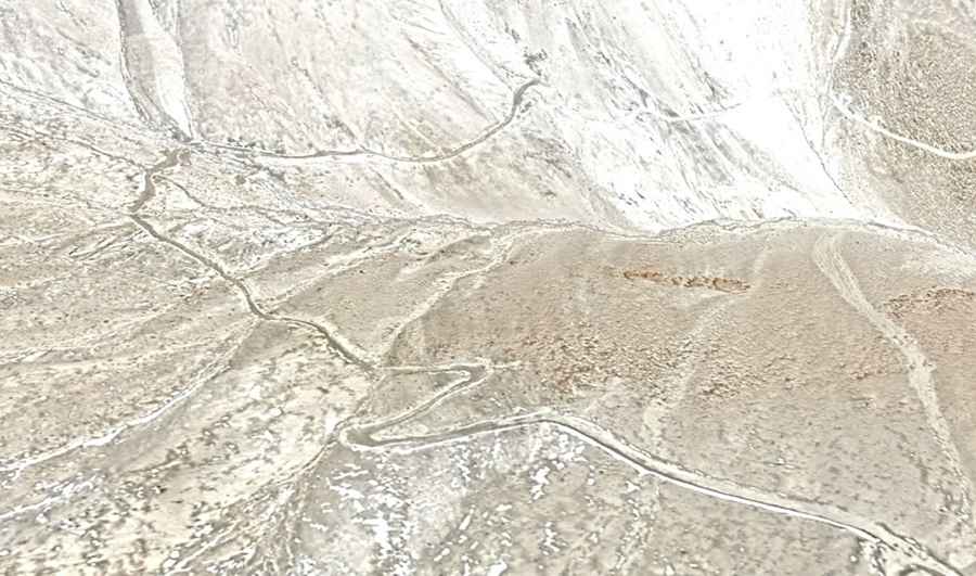
Cerro Umurata, also known simply as Umurata, is a volcano situated on the border of Bolivia and Chile. A 4x4 mining trail ascends to an altitude of 5,542 meters (18,182 feet) above sea level near the summit, offering breathtaking views of the Andean highlands. It’s one of the highest roads of South America.
Where is Cerro Umurata?
Nestled within the majestic Andes mountain range, Cerro Umurata is part of the Nevados de Quimsachata group. It straddles the border of the Arica and Parinacota Region of Chile and the Oruro Department of Bolivia. This unique location contributes to the breathtaking beauty of the landscape.
Can you drive to Umurata?
The route leading to the volcano is a rugged mining road initially constructed to access the sulphur mines near the summit. The road is entirely unpaved, starting from Chachacomani in Bolivia. Over a span of 15.1 kilometers (9.38 miles), the road ascends by 1,266 meters, with an average gradient of 8.38%. This challenging path leads to a sulphur mine on the mountain, where efforts are underway to establish structures at this high elevation. It is one of the highest roads in the country.
Is the road to Cerro Umurata open in winter?
Nestled high in the Cordillera Occidental, north of Volcan Acotango, the road to Cerro Umurata is typically open only during the summer months. However, it's essential to note that the route can be subject to closures at any time, primarily due to the risk of avalanches and heavy snowfalls that may obstruct certain sections of the road.