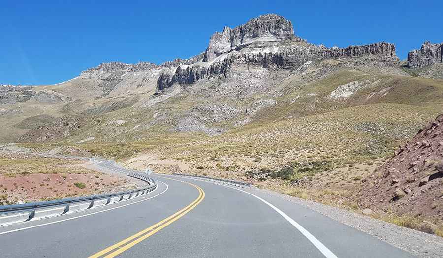
An Andean mountain road to Pehuenche Pass
Paso Pehuenche is an international high mountain pass at an elevation of 2.557m (8,389ft) above sea level, on the border of Chile and Argentina.
Where is Pehuenche Pass?
The pass links Mendoza Province in Argentina and the Chile's Maule Region.
Is Pehuenche Pass paved?
The road to the summit is paved in good shape. It was entirely paved in 2018. The road is called Ruta internacional CH 115 (in Chile) and Ruta nacional 145 (in Argentina).
How long is Pehuenche Pass?
The pass is 167km (104 miles) long running east-west from Las Loicas (in Mendoza Province of Argentina) to San Clemente (in the Talca Province of Chile's Maule Region).
How long does it take to drive through Pehuenche Pass?
To drive the road without stopping will take most people between 2.5 and 3.5 hours. Be alert for wildlife, especially in the higher elevations along this route. The road to the summit is very steep, hitting an 11% of maximum gradient through some of the ramps.
Is Pehuenche Pass open?
Set high in the Andes mountain range, the pass is usually open from December to March. Exact dates depend on the state of the pass after the winter.