What are the most spectacular roads in Chile?
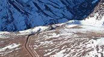
From the dunes of the Atacama to the ice of Patagonian glaciers, Chile is a dream for road trip enthusiasts. Located in South America, the narrow and long country hosts a never-ending list of mountain passes acting as a border with other countries. It’s worth remembering the country shares borders with Argentina, Bolivia and Peru. So, prepare to conquer Agua Negra Pass, the highest road between Argentina and Chile. At an elevation of 4.774m (15,662ft) above sea level and located on the border of Argentina and Chile, it's one of the highest roads in Chile. And, don’t miss Planchon Pass in the Andes, at 2.515m (8,251ft) above sea level, on the border with Argentina.
When you travel to Chile, there are hundreds of roads that must be in your list as it hosts more than 150 roads listed on the most spectacular drives in the world. Starting on Ruta 5, part of the Panamerican Highway, that offers a glimpse of Chile's dramatic geography; Paso Internacional Los Libertadores, a series of hairpin turns on the border with Argentina, and ending at Ojos del Salado stratovolcano, the world’s highest active volcano. At 6,891m (22,608ft) above sea level, this mountain has been the scene of several records for attaining the highest altitude aboard a land vehicle. It’s one of the highest accessible points by car on Earth.
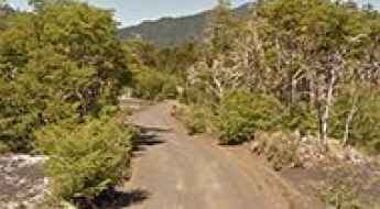
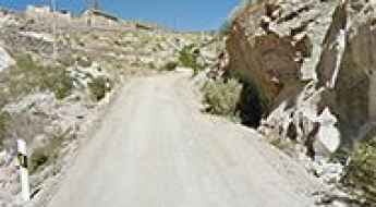
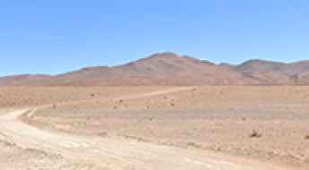
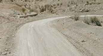
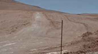
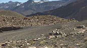
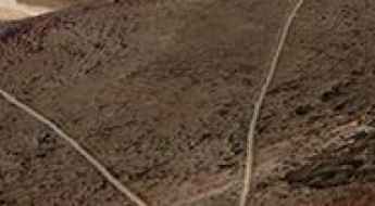
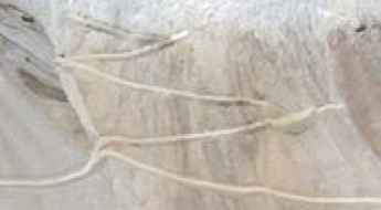
Road R-925-S
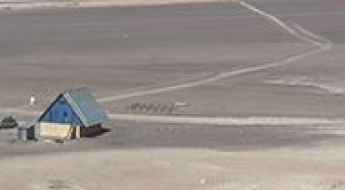
R-925-S is a very scenic drive located at the foot of the Andes, in the Province of Cautín, Araucanía Region, in Chile.
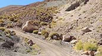
How to drive through San Juan Pass in the Andes?
Paso de San Juan is a high mountain pass at an elevation of 3.607m (11,833ft) above sea level, located in the San Pedro de Atacama commune, in Chile.
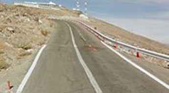
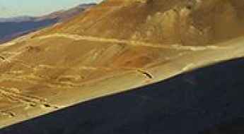
Driving the steep road to La Silla Observatory in the Atacama
La Silla is a high mountain peak at 2,400 meters, standing as a sentinel in the southern Atacama Desert of northern Chile. This is the driest and most remote desert on Earth, and the road to the summit, the C-541, is the only lifeline to one of the world's most important astronomical hubs. While the road is asphalted to allow for the transport of delicate optical equipment, the drive is a brutal encounter with the Andean foothills, where the heat, the isolation, and the steep gradients test the cooling system and the driver's focus at every kilometer.
Quebrada Blanca
Quebrada Blanca is a high mountain pass at an elevation of 4.389m (14,399ft) above the sea level, located in the Tarapacá Region of Chile.
Claudio Lucero Refuge
Refugio Claudio Lucero is a high mountain refuge at an elevation of 4.527m (14,852ft) above the sea level, located in the Atacama Region of Chile, near the Argentinian border.
Valle Nevado chairlift
Valle Nevado chairlift lies in the Andes Mountains of Chile, at an elevation of 3.306m (10,846ft) above the sea level.
Cerro Canasa
Cerro Canasa is a high mountain pass at an elevation of 4.304m (14,119ft) above the sea level, located in the Chilean Tarapacá Region, near the Bolivian border.
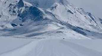
Nevados de Vilcún
Nevados de Vilcún is a ski resort at an elevation of 1.508m (4,947ft) above the sea level, located within the Conguillío National Park, in the Araucania region of Chile.
Mirador de Toconce
Mirador de Toconce is a high mountain observation deck at an elevation of 3.339m (19,954ft) above the sea level located in the Antofagasta region of Chile.
Atacama Refuge
Refugio Atacama is a high mountain refuge at an elevation of 5.256m (17,244ft) above the sea level, located in the Atacama Region of Chile, near the Argentinian border.
How to drive the high-altitude mine road to Volcán Apagado?
Volcán Apagado is a high-altitude volcanic peak reaching an elevation of 5,343m (17,529ft) above sea level, situated on the international border between Chile (Antofagasta Region) and Bolivia (Potosí Department). The access is a 14.6 km unpaved mine road that starts from the B-145 road near Ayaviri. Logistically, this is an extreme off-road sector characterized by deep volcanic sand, loose scree, and a complex network of poorly defined tracks that make navigation technically difficult even with GPS support.
How to drive the unpaved Ruta Lapislázuli to Paso la Chapetona?
Paso la Chapetona, also known as Paso del Azufre Norte, is a high mountain pass at an elevation of 3,654m (11,988ft) above sea level, situated on the border between Chile and Argentina. For drivers, this is a dead-end mining track known as Ruta Lapislázuli, which climbs the Andes from the Chilean side toward the mineral deposits of the Coquimbo Region.
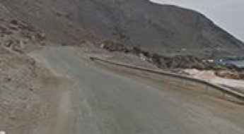
Cerro Capi
Cerro Capi is a mountain at an elevation of 965m above the sea level located in northern Chile’s Atacama Desert. The road is extremely steep, with sections up to 15%.
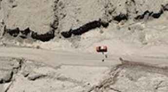
Driving the steep and truck-filled Cuesta de Llanta
Cuesta de Llanta is one of the most punishing and high-pressure sections of road in the Atacama Desert. Located in the Chañaral Province of northern Chile, this short but brutal climb is part of the Route C-13, the main lifeline for the massive mining operations in Diego de Almagro and the ghost town of Potrerillos. It is a world of dust, heat, and heavy machinery where the asphalt is constantly tortured by the weight of oversized trucks. Driving here is an exercise in patience and nerves, as you navigate steep inclines while surrounded by the constant roar of industrial traffic.
Cerro Camellos: A high-altitude 4x4 challenge in the Atacama Desert
Reaching the summit of Cerro Camellos is like driving on another planet. At 4,431m (14,537ft) above sea level, this peak in the Tarapacá Region of northern Chile is a place of absolute isolation. The landscape is a mix of volcanic rock, white dust, and a sky so blue it feels artificial. If you decide to leave the asphalt and head up here, make sure your vehicle is ready for the thin air and the punishing desert heat.
Azufrera Tacora
Azufrera Tacora is an abandoned sulphur mine at an elevation of 4.518m (14,822ft) above sea level, located on the border of Chile and Peru.
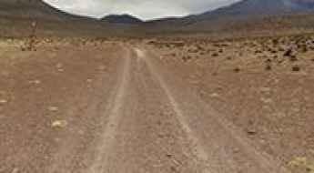
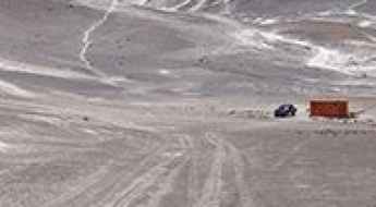
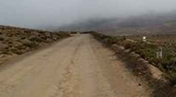
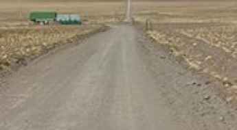
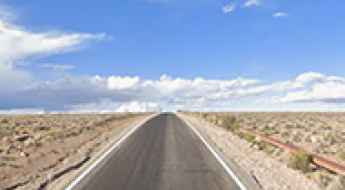
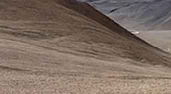
Road D-447
Carretera D-447 is a very scenic drive located in the Elqui Province, Coquimbo Region, in Chile. This is a maintained road where a high clearance 2WD vehicle is able to travel safely at low speeds on long dry straight-of-ways, without losing control due to wash boarding, ruts, or dips.
Paso Guaitiquina
Paso Guaitiquina is a high mountain pass at an elevation of 4.451m (14,603ft) above the sea level located in the Antofagasta Region of northern Chile. The climb is simply terrible, with a notorius lack of oxygen that tests the organisms and a high degree of steepness. Most people feel altitude sickness at around 2,500-2,800 meters. Near the pass, oxygen is in short supply.
Portezuelo El Gaucho
Portezuelo El Gaucho is a high mountain pass at an elevation of 4.177m (13,704ft) above the sea level, located in Huasco Province, in Atacama Region of Chile.
Is the road to Cerro Azufrera de los Cuyanos the ultimate high-altitude test in Chile?
Cerro Azufrera de los Cuyanos is a massive volcano located in the Atacama Region of Chile, near the border with Argentina. The track leading to its slopes is one of the highest roads in the country, reaching a staggering elevation of 5,553m (18,218ft) above sea level. This extreme mine road is reserved only for the most experienced off-roaders and specialized vehicles.
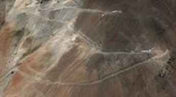
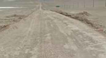
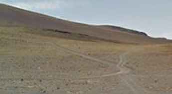
Road B-898
Carretera B-898 is a very scenic drive located in Antofagasta Province, in northern Chile. The road, also known as Ruta Patrimonial de Taltal, is 30.0 km long.
Driving to Casiri Hembra and Macho: High-altitude lagoons in the Chilean Andes
Laguna Casiri Hembra and Laguna Casiri Macho are a pair of stunning high-altitude mountain lagoons located in the Arica and Parinacota Region of Chile. Situated near the Bolivian border, the road to these lakes is one of the highest driving routes in the country, surrounded by a dramatic landscape of volcanoes.
Scaling the Skies: The Journey Up Putana Volcano- Among Earth's Highest Roads on Earth
Volcán Putana is a stratovolcano located in the Antofagasta region of Chile. A former mine access road climbs up to 5.779m (18,959ft) above the sea level. It’s one of the highest roads on Earth.
Portezuelo Caballo Muerto
Portezuelo Caballo Muerto is a high mountain pass at an elevation of 4.410m (14,468ft) above the sea level, located in the Nevado Tres Cruces National Park in the Atacama Region of Chile.
A gravel road to the Damas Pass border in the Andes
Paso de las Damas is an international high mountain pass at an elevation of 3.081m (10,108ft) above the sea level, located on the border of Chile and Argentina, in the Andes mountains.
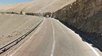
Driving the paved A-23 road to Abra Chapoco in northern Chile
Abra Chapoco is a high-altitude mountain pass reaching 4,400 meters in the Parinacota Province, at the northernmost tip of Chile. Sitting just a stone's throw from the Peruvian border, the road through the pass—the A-23—is a remarkable piece of infrastructure that was fully paved during the 2010s. This is a journey through the silent Altiplano, a route where the asphalt cuts a straight line through a barren, mineral landscape, dominated by the silhouette of the Volcán Tacora and the thin, biting air of the high Andes.
Portezuelo de Chulluncallani
Portezuelo de Chulluncallani is a high mountain pass at an elevation of 4.492m (14,737ft) above the sea level, located in the Arica y Parinacota Region, in Chile, near the Bolivian border.
Portezuelo El Choclo
Portezuelo El Choclo is a high mountain pass at an elevation of 3.375m (11,072ft) above the sea level, located in the Atacama region of Chile.
Road trip guide: Conquering Mina Centinela
Mina Centinela is a high mountain copper mine located in the Atacama Region of Chile. It’s one of the highest roads of the country.
The Ultimate Guide to Conquering Cerro Tecar
Cerro Tecar is a high mountain peak at an elevation of 5.088m (16,692ft) above the sea level, located in the Antofagasta region, in northern Chile’s Atacama Desert. It’s one of the highest roads of the country.
A wild mining road to Vicuña volcano in the Andes
Vicuña is a volcano at an elevation of 5.495m (18,028ft) above sea level, straddling the border between Argentina and Chile. It’s one of the highest roads in the country.
Driving the high altitude mining road to Cerro Carasilla
Cerro Carasilla, also known as Cerro Carecilla, is a massive peak that breaks the 5,000-meter barrier in the Antofagasta Region of Chile, right on the edge of the Bolivian border. The track that grinds its way to the summit was built for mining operations and is a brutal mix of jagged rocks and loose ripio. Driving here means taking your vehicle to one of the highest points on the planet where a road still exists—a mineral and desolate world where altitude sickness doesn't just hit the driver, but leaves engines gasping for any bit of oxygen they can find.
Cerros de Anocarire
Cerros de Anocarire is a high mountain peak at an elevation of 4.845m (15,895ft) above the sea level, located in the Arica and Parinacota Region, Chile.
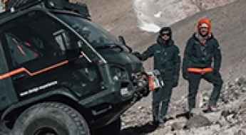
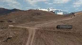
A truck powered by solar energy sets altitude record: it has climbed a volcano in Chile
The transportation of goods by road still lacks heavy electric vehicles that meet certain operational needs. As a result, companies in the sector and drivers continue to await the development of hydrogen fuel cell technology and electric battery systems as solutions to the specific requirements of professional transportation. However, the industry is also considering other options, as demonstrated by the Swiss solar truck that has achieved an impressive feat by conquering the highest active volcano on Earth, located in Chile.
An epic road to Abra Mina Maricunga in the Andes
Abra Mina Maricunga is a high mountain pass at an elevation of 4.567m (14,983ft) above the sea level, located in the Atacama Region of Chile.
A 4x4 mine road to Cerro El Potro in the Andes
Cerro El Potro is a mountain peak at an elevation of 5.472m (17,952ft) above sea level, straddling the border between Argentina and Chile. It’s one of the highest roads of the country.