How To Travel The Steep SC-370 Road To Serra do Corvo Branco
Altos Corvo Branco is a mountain pass at an elevation of 1.245m (4,084ft) above sea level, located in the State of Santa Catarina, Brazil.
Where is Altos Corvo Branco?
The pass is located within the Santa Catarina mountains, within the Serra do Corvo Blanco (the White Crow's Mountain) range, in the southern part of the country.
Is Estrada da Serra do Corvo Branco paved?
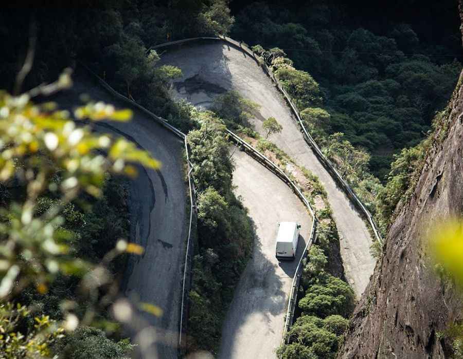
The road to the summit is mostly paved. It’s called SC-370 (Estrada da Serra do Corvo Branco) and runs between two steep rocky cliffs.
How long is Estrada da Serra do Corvo Branco?
The road is 67km (41 miles) long, running from Braço do Norte to Urubici. It’s one of the links between the South of Santa Catarina and the Planalto Catarinense.
Is Estrada da Serra do Corvo Branco difficult?
The drive is extremely challenging, not for a Sunday drive. The last 1.6km to the climb are brutal, with 30% sections and 5 hairpin turns. The drive offers countless turns, narrow parts, steep descents, and breathtaking cliffs, with unforgettable panoramic views. Use low gears. Expect very tight curves and viewpoints at each of the curves. Very dangerous with rain or fog. Not recommended for buses or larger vehicles.
Pic: Mirante Altos Corvo Branco