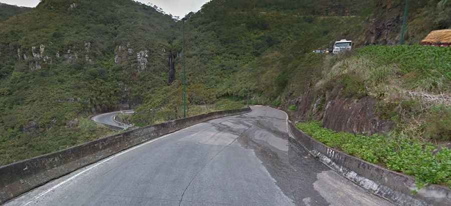
SC-390 is a Brazilian ludicrously zigzagged road in Serra do Rio do Rastro
SC-390 is a sharply winding and precipitous ascent on a steep and narrow zigzag road located in the southeast of the state of Santa Catarina, Brazil. It’s one of the famous hairpinned roads in the world.
Where is the SC-390 road?
This road (also called Rodovia Daniel Brüning) is located in the state of Santa Catarina, in the southern corner of the country. Santa Catarina state was colonized by Germans and Italians, and its culture is very European. You will notice that the houses are built in German style and people have very fair skin.
When was the SC-390 road built?
The road was built in 1903. Set high in Serra do Rio do Rastro, a mountain range located in Lauro Müller, the road tops out at an elevation of 1,465m (4,806ft) above sea level.
Is the SC-390 road worth it?
In the highest areas of this place, the Atlantic Ocean, located about 100 km (62 mi) away, can be spotted on clear days. This is just one of the characteristics that make this place special and unique since there are lakes, falls, cascades, native wildlife, and stunning nature, which cause this region to be one of the most beautiful places in Brazil.
How challenging is the SC-390 road?
The road is totally paved and has remarkable landscapes and deep crags. It’s 12.87 km (8 miles) long. The journey of the Sierra do Rio do Rastro goes from 4,790 feet to sea level in only eight miles, with an average gradient of 9.2%. But if you think this is going to be some leisurely afternoon putt-putt, think again: there are 250 corners. Lighting is provided to the whole road by huge windmills. There's little traffic.
What’s the weather like in Serra do Rio do Rastro?
Tucked away in the southern part of the country, this ludicrously zigzagged route tumbles past waterfalls, through canyons, and past spectacular scenery from start to finish. Summer (December 'til March) is the preferred time of the year to visit because in the winter there's too much fog. That's not to say there is no fog in the summer, but only when a cold front comes from the south. The coldest town in Brazil is Sao Joaquim da Serra, about 20 miles far from the Serra do Rio do Rastro. Temperature drops to below zero, and snow falls in the winter. The climate in this region is temperate due to its altitude of about 1,500m and its proximity to the sea, resulting in an annual average temperature of 12° C.