Cordón de Inacaliri: Driving the 5,395m mining track on the Chile-Bolivia border
Reaching a staggering elevation of 5,395m (17,700ft) above sea level, Cordón de Inacaliri is a massive volcano situated on the international border between Chile and Bolivia. Located in the heart of the Central Andes, the track to its summit is one of the highest roads in the country, originally carved as a mining access route through one of the most inhospitable environments on Earth.
| Road facts: Cordón de Inacaliri | |
|---|---|
| Location | Chile (Antofagasta) - Bolivia (Potosí) Border |
| Elevation | 5,395 m (17,700 ft) |
| Road Type | Mining Road (Gravel & Rock) |
| Vehicle Required | Strictly 4x4 High Clearance |
| Oxygen Level | ~40% less than at sea level |
Where is the road to Cordón de Inacaliri?
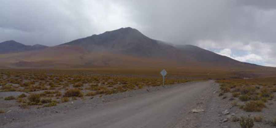
The track straddles the boundary between the Nor Lípez province in the Bolivian department of Potosí and the Ollagüe province in the Antofagasta Region of Chile. The journey starts near the small settlement of Inacaliri. Mapping a precise route in this area is nearly impossible as the high-altitude winds and shifting scree constantly alter the path. This is a pure Andean frontier where the road is often "tippy" and bumpy, requiring a driver who is completely devoted to slow, obstacle-conscious progress.
Is the road to Cordón de Inacaliri unpaved?
Yes, the road is a brutal mix of gravel and loose rock. As an active or former mining road, it was designed for heavy-duty machinery, not for comfort. The surface is constantly changing due to the extreme erosion of the Puna. A 4x4 vehicle is not just recommended; it is a life-saving necessity. The steep drive demands a high tolerance for vertigo, as the track clings to the volcanic slopes with zero protection. Do not commit your vehicle to the path ahead until you have scouted it; at 5,000 meters, a single mistake like getting high-centered or losing traction on a "tippy" section can have serious consequences.
What are the health risks at Cordón de Inacaliri?
The most dangerous factor of this drive is the notorious lack of oxygen. At the summit, there is about 40% less oxygen than at sea level. This tests both the human organism and engine combustion. Most people feel altitude sickness starting at 2,500 meters, but at 5,395m, the risk of severe soroche (altitude sickness) is extreme. Movement becomes laborious, and your pulse rate will skyrocket. Because of these risks, individuals with respiratory problems or heart conditions—and babies under 4 months—must strictly avoid this ascent. Driving here requires total alertness despite the mental fog caused by the altitude.
Is the road to Cordón de Inacaliri open year-round?
No. Winter comes early and stays late in the Central Andes. You may only be able to safely run this trail in the middle of the summer. Even then, the road is subject to rapid weather changes, and snowy days can occur in mid-summer. High winds blow all year long, and temperatures in the winter are brutally cold, often dropping far below -20°C. Ice and snow can accumulate on the track without warning, making the rocky surface treacherously slick. Proper preparation, including extra fuel, oxygen, and cold-weather survival gear, is essential before leaving Inacaliri behind.
Pic: marceloescobarberna