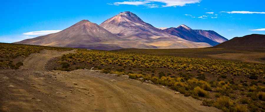
Driving the high-altitude mining track to Cerro Cañapa in Bolivia
Cerro Cañapa is a mountain peak at an elevation of 5,629m (18,467ft) above sea level, located in the Nor Lípez province, Potosí Department, in Bolivia. The route to the summit is a dirt track built for sulfur mining operations near the border with Chile. It is one of the highest roads of South America.
| Road facts: Cerro Cañapa | |
|---|---|
| Location | Nor Lípez, Potosí, Bolivia |
| Elevation | 5,629 m (18,467 ft) |
| Length from Alota | 102.5 km (63.7 miles) |
| Surface | Unpaved / Mining Track |
Where is the road to Cerro Cañapa?
The route to the mountain begins at the settlement of Alota. The drive spans 102.5 km (63.7 miles) over unpaved Andean terrain, with an elevation gain of 1,203 meters. It is on the list of the highest roads of Bolivia.
What are the road conditions on the Cerro Cañapa mining track?
The surface consists of loose volcanic soil, heavy gravel, and stones. The track is single-lane wide with deep washboard ridges and ruts carved by mining trucks. Due to the grade and the loose stones, a high-clearance 4x4 vehicle is required to avoid slamming the undercarriage against the center mound. The route has no steel guardrails, asphalt shoulders, or mechanical aid stations for 100 kilometers.
What are the hazards driving to Cerro Cañapa?
The altitude of 5,629 meters reduces engine power due to the low oxygen level. The track runs below raw rock walls prone to stone collapses and landslides that block the roadbed. The descent requires low gears to control the vehicle weight on the steep gravel ramps. Freezing winds and blizzards occur on the high plateau, turning the dirt tracks into mud or packing them with snow drifts from May to September.
Pic: By profe_miguel - originally posted to Flickr as Uyuni-4846, CC BY-SA 2.0, https://commons.wikimedia.org/w/index.php?curid=7056913