How to drive the challenging road to La Cumbre?
La Cumbre is a high mountain pass at an elevation of 4,506 m (14,783 ft) above sea level, located in the Cochabamba department of Bolivia.
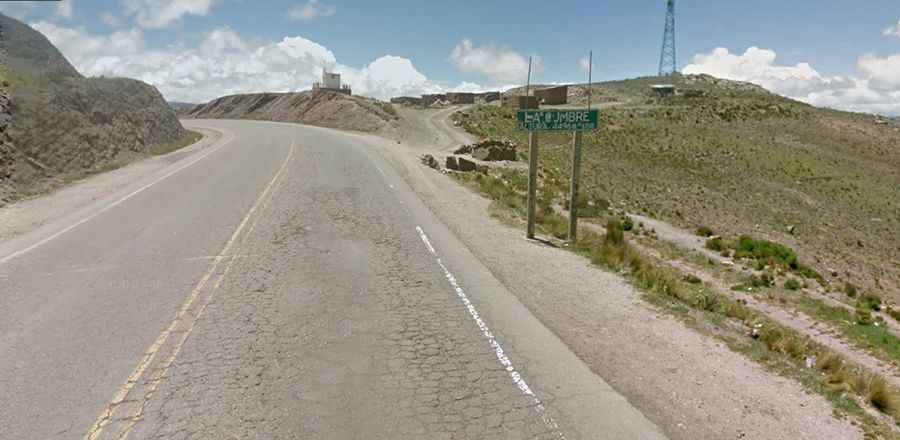
Is the road to La Cumbre paved?
The road to the summit is fully paved and in pretty good condition but very curvy and steep. It’s called Carretera Oruro – Cochabamba (Ruta 4).
How long is the road to La Cumbre?
The road through the pass is 71.5 km (44.42 miles) long, running east-west from Challa Grande to Caihuasi.
Why is the road to La Cumbre famous?
Located in the center of the country, the climb has been featured in the Vuelta Ciclista a Bolivia bicycle race. It’s the highest stage in the UCI road race calendar.
How demanding is the drive through La Cumbre?
If you suffer from heart issues or respiratory conditions, this drive is not recommended. The pass is known for its thin air and steep climbs, which put a serious strain on both the body and vehicles. Many travelers begin to experience altitude sickness once above 2,500–2,800 meters, as oxygen levels drop sharply. At the summit, there is roughly 40% less oxygen than at sea level, making breathing more difficult, increasing heart rate, and causing even simple movements to feel exhausting. The combination of extreme altitude, the risk of altitude-related illness, unpredictable mountain weather, steep gradients, and overall remoteness makes this pass a demanding and potentially dangerous route.