How to drive the gravel road to Mecoya-Mecoyita Pass?
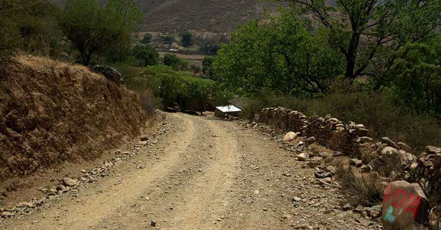
The Mecoya-Mecoyita Pass (Paso de Mecoyita) is an international high mountain crossing at an elevation of 2,373m (7,785ft) above sea level, situated on the border between Argentina and Bolivia. The route spans 4 km, linking the settlement of Mecoyita in the Salta Province (Argentina) with Mecoya in the Tarija Department (Bolivia). The track is known as RN45 on the Bolivian side and remains unnamed on the Argentinian sector, consisting of a technical gravel surface that is highly sensitive to moisture.
| Road facts: Mecoya-Mecoyita Pass | |
|---|---|
| Location | Argentina (Salta) - Bolivia (Tarija) |
| Elevation | 2,373m (7,785ft) |
| Length | 4 km |
| Surface | Unpaved (Gravel / Clay) |
| Road Name | RN45 (Bolivia) |
What is the road condition of the Mecoya-Mecoyita Pass?
The 4 km transit across Mecoya-Mecoyita Pass is characterized by a loose gravel surface that frequently shifts along the road shoulders. The technical composition of the soil includes high clay content, meaning that even moderate rainfall turns the track into a muddy and slippery corridor. Under these conditions, lateral traction is almost non-existent, making the track impassable even for 4x4 vehicles. The road is steep and narrow, with significant exposure in the sectors where the track winds along the riverbed that marks the international boundary.
What are the 4x4 logistics for the Argentina-Bolivia border?
Reaching an elevation of 2,373 meters requires a vehicle with a reliable torque range. Logistically, the Paso de Mecoyita is a remote crossing with no mechanical support or fuel stations for several dozen kilometers in either direction. Drivers must be self-sufficient, carrying extra fuel and essential spare parts. The technical difficulty increases during the summer rainy season (December to March), when flash floods can wash out sections of the gravel road or deposit large rocks on the driving line. High ground clearance is a mandatory requirement to navigate the deep ruts and washboard sections common on Bolivian RN45.
How to manage weather and safety at Mecoya-Mecoyita?
Visibility and traction are the primary safety concerns on the Mecoya-Mecoyita track. Sudden storms in the Salta highlands can rapidly deteriorate the road surface. It is a technical protocol to check the meteorological reports for the Tarija region before starting the 4 km transit. In the event of becoming bogged down in mud, self-recovery equipment such as sand ladders and a winch are necessary, as the low traffic volume in this sector makes external assistance unlikely. Furthermore, drivers must ensure all customs and border documentation are ready, as the logistics of this secondary crossing are managed by small local detachments with specific operating hours.
Vehicle requirements for the Salta to Tarija gravel track
A high-clearance 4x4 equipped with All-Terrain (A/T) tires is the minimum technical requirement for the Mecoya-Mecoyita Pass. Before departure, verify the integrity of your suspension system and tire sidewalls, as the abrasive gravel can lead to punctures. It is essential to carry a full-size spare tire and a heavy-duty jack capable of operating on soft ground. Logistically, ensure your battery and electrical systems are in peak condition, as the temperature fluctuations at 2,300 meters can be extreme. Carrying a satellite communication device is recommended due to the lack of cellular coverage along this border sector.
Pic: Jorge Morato