How to drive the remote 4x4 route to Abra Mallachuma?
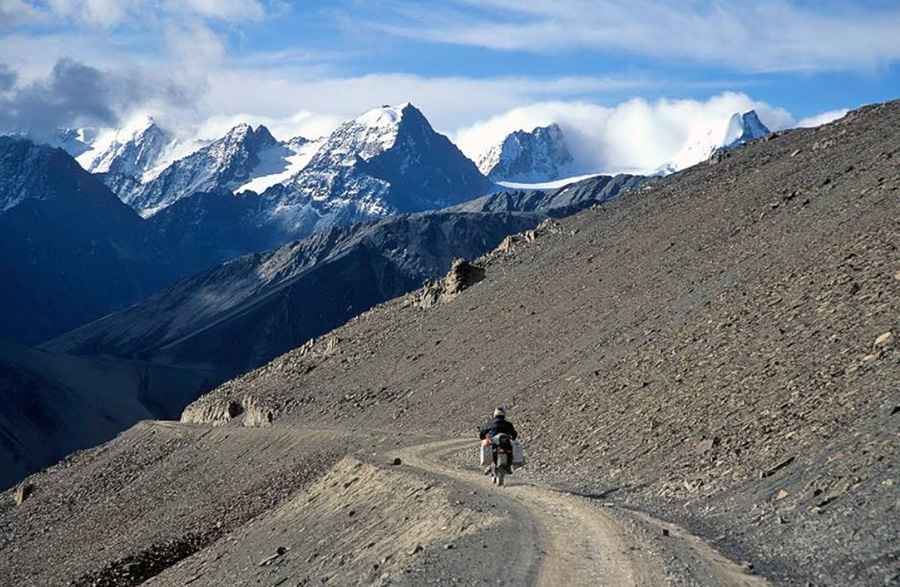
Abra Mallachuma is a high-altitude mountain pass rising to 5,131m (16,833ft) above sea level, situated in the La Paz Department of Bolivia. It’s one of the highest roads in the country.
Where is Abra Mallachuma located?
The pass lies to the west of Quime, within the Inquisivi Province, in the western Bolivian Andes.
Is the route to Abra Mallachuma paved?
No — the road is entirely unpaved and follows an old mining track. A 4x4 vehicle is essential due to its narrow stretches and steep climbs. While the journey rewards travelers with spectacular lagoon vistas, it also demands caution because of its sheer drop-offs and exposed edges.
How long is the road to Abra Mallachuma?
The track covers roughly 67.8 km (42.12 miles), running north–south and linking Araca with Rodeo. The challenging terrain and lack of services make preparation key before setting out.
How dangerous is the drive to Abra Mallachuma?
Driving this road keeps you constantly at around 5,000m (16,400ft) or higher, where thin air and reduced oxygen create significant risks. Altitude sickness can strike even the healthy, causing headaches, dizziness, nausea, or shortness of breath. Low oxygen levels may also reduce engine efficiency, especially for vehicles without turbochargers. Weather can shift abruptly, bringing snow, ice, or bitter cold, even during summer months. Always spend time acclimatizing, keep hydrated, and limit physical exertion until your body adjusts. Equip yourself with warm layers, drinking water, and emergency gear — assistance could be many hours away.
How to drive the road to Lago Laramcota?
The dirt track climbs up to 4,851 meters above sea level, where you hit Lago Laramcota (also known as Laram Quta). Near the southwest side of the lake, an old mining road branches off and climbs even higher, topping out at an elevation of 5,134 meters.
Road suggested by: Hugh Wilson
Pic: JHONN WILDER PERALTA LAURA