Reaching the Sky on the Winding Road to Alto Pacuni in the La Paz Department
Alto Pacuni is a high mountain pass at an elevation of 4,900m (16,076 ft) above sea level, located in the La Paz Department in Bolivia. It’s one of the highest roads in the country.
Where is Alto Pacuni?
The pass, named after the nearby town of Pacuni, is located in Inquisivi Province, in the western part of the country, within the Caracoles Mining District.
How challenging is the road to Alto Pacuni?
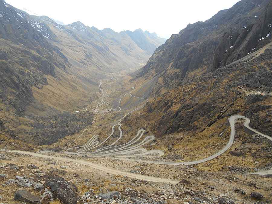
The road through the summit is totally unpaved, and a 4x4 vehicle is recommended. It’s called Camino a Choquetanga. It’s not an easy drive, with countless turns, hundreds of hairpin bends, steep sections, and narrow parts. The road is heavily used by mining trucks due to the presence of a mine, known as Mina La Argentina, near the summit.
How long is the road to Alto Pacuni?
The road through the pass is 22.6 km (14.04 miles) long, running south–north from Pacuni to Choquetanga.
Is the road to Alto Pacuni worth the drive?
The road, with a few tunnels, overhanging cliffs, and lakes, provides stunning views of the mountains and a few lagoons. The most famous ones are Laguna Recompensa and Laguna Miguillas.
How dangerous can reaching the altitude of Alto Pacuni be?
At this elevation, the risk of altitude sickness becomes significant, especially for those not acclimatized. Common symptoms include headache, nausea, dizziness, shortness of breath, and fatigue. In severe cases, it can lead to high-altitude pulmonary edema (HAPE) or high-altitude cerebral edema (HACE), both of which can be life-threatening. Travelers should ascend gradually, stay hydrated, and avoid overexertion. If symptoms worsen, immediate descent is critical.
Road suggested by: Hugh Wilson
Pic: José Carlos González Escudero