Dare to drive the dangerous road to Abra del Condor
Abra del Cóndor is a high mountain pass at an elevation of 3.942m (12,933ft) above sea level located in Argentina.
Where is Abra del Condor?
The pass is located on the boundary between Jujuy and Salta provinces, in the northwestern part of the country.
How long is Abra del Condor?
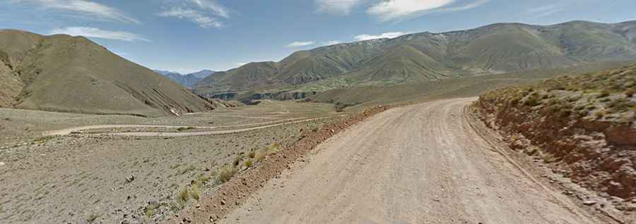
The road to the summit is not for the sissies. It comprises the unpaved RP133 and RP13 roads, known as Carretera de Iruya, straddling Jujuy and Salta provinces. It’s the highest point of the road. The pass is 47.4 km (29.45 miles) long, running from the paved RN9, north of Humahuaca, to the picturesque village of Iruya. It’s a difficult drive, with countless curves and hairpin turns, dangerous drop-offs with very narrow parts and fording many rivers.
Is Abra del Condor worth the drive?
The area offers awesome mountain settings, isolated villages and spectacular off-road trails. The road offers spectacular views of the valley and cultivated terraces, surrounded by colorful mountains and bizarrely eroded rock walls.
When is the best time to drive Abra del Condor?
The road is very dry usually, but summer rainstorms can make it impassable. The best months to travel in this area are June, July, August, September and October.