How to drive the extreme 4x4 road to Laguna Cerro Negro?
Laguna Cerro Negro is a high mountain lake at an elevation of 4,492m (14,737ft) above sea level, located in the Jujuy Province, in Argentina.
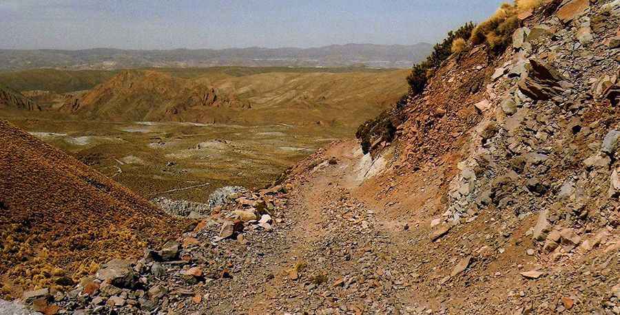
| Road facts: Laguna Cerro Negro | |
|---|---|
| Location | Jujuy Province, Argentina |
| Starting Point | Lagunillas del Farallón |
| Length | 17.7 km (11 miles) |
| Max Elevation | 4,625 m (Cuesta del Farallón) |
| Surface | Gravel and Rocky |
| Hazard Level | Extreme (Altitude & Drop-offs) |
Why is it called Laguna Cerro Negro?
Tucked away in the High Andes, the lake is named after the dark volcanic rock of the mountain
How long is the road to Laguna Cerro Negro?
The road to the lagoon is approximately 17.7 km (11 miles) long starting from the small village of Lagunillas del Farallón.
What is the highest point on the drive to Laguna Cerro Negro?
Before reaching the lake, the road climbs even higher to reach Cuesta del Farallón. This high mountain pass stands at an elevation of 4,625m (15,173ft) above sea level, making it one of the highest drivable points in the region.
Is the road to Laguna Cerro Negro unpaved?
The road is entirely unpaved, with a surface consisting of gravel and loose rocks. It is extremely narrow and, in many places, bordered by vertical drops of hundreds of meters without any guardrails. Due to these conditions, the road is impassable for two cars at the same time; one driver might have to reverse for kilometers to find a passing point. The road includes countless hairpin turns and extremely steep sections that require professional driving skills. The route becomes impassable after rain, as the mud and slippery rocks make the steep ramps too dangerous to navigate.
Can I drive my vehicle on the road to Laguna Cerro Negro?
A 4x4 vehicle is required. Driving here is only recommended for those with extensive experience in high-altitude mountain roads and fully prepared vehicles.
Road suggested by: Hugh Wilson
Pic: http://iglesiasypaisajesdesudamerica.blogspot.com/2010/11/cuesta-del-farallon-jujuy-argentina.html