The Inhumane Climb to Cerro El Amago with 19% Ramps
Cerro El Amago is a high mountain pass at an elevation of 1,703m (5,587ft) above sea level, located in San Luis Province in Argentina.
Where is Cerro El Amago?
Located in the central part of the country, at the peak of the mountain, there are many antennas for broadcasting TV signals and telephony.
Is the road to Cerro El Amago paved?
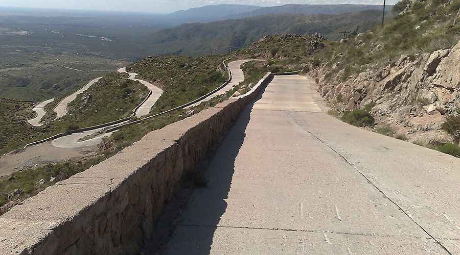
The road to the summit is fully paved, with some concrete sections near the summit. It’s called Provincial Route 9. It’s a long, brutal climb, very demanding, and the final part is covered in wrinkled cement.
How long is Cerro El Amago?
The pass is 35.1 km (21.81 miles) long, running north-south from San Francisco del Monte de Oro to Carolina. The ascent is very steep. Starting from San Francisco del Monte de Oro, the ascent is 17.4 km (10.81 miles) long. Over this distance, the elevation gain is 905m, and the average gradient is 5.2%, hitting 19% through some of the ramps (200m between 10.8 and 11 km).
Is Cerro El Amago worth the drive?
Tucked away in the Argentinian Precordillera, the drive is very scenic with excellent views: San Francisco, a deep gorge, Cerros del Socoscora, Valle Reservoir Las Palmeras... And you can observe the condors.
Pic: Club Atletico Rincon