Driving the Scenic Camino 6 de Septiembre to Cerro Pan de Azúcar in Córdoba
Cerro Pan de Azúcar is a famous mountain pass reaching an elevation of 1,023m (3,356ft) above sea level in the Sierras Chicas of Córdoba, Argentina. The road over the pass, known as the Camino 6 de Septiembre, is a classic mountain route connecting the Punilla Valley with the Sierras Chicas.
What is at the summit of Cerro Pan de Azúcar?
The summit is a major tourist landmark. It is dominated by a massive 14-meter iron cross, which is visible from miles away. Visitors can also find a restaurant, a parking lot, and the famous "Aerosilla" (chairlift) that takes tourists to the very top for a panoramic view of the Punilla Valley and the city of Córdoba.
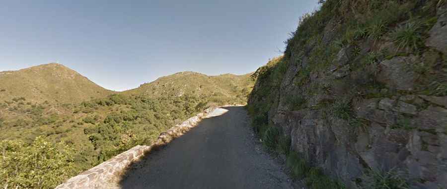
Is the road to Cerro Pan de Azúcar in Córdoba paved?
The road through the summit features both paved and unpaved sections. Known officially as Ruta Provincial 54, this dirt track was built in 1931. It remains a rugged and curvy mountain road, offering a true "old-school" driving experience. While parts near the towns are improved, long stretches consist of loose gravel and earth that require careful navigation.
⛰️ Cerro Pan de Azúcar (RP54) Data
| Summit Elevation | 1,023m (3,356ft) |
| Year Built | 1931 (Camino 6 de Septiembre) |
| Main Landmark | 14-meter Iron Cross |
| Total Length | 28km (17 miles) |
How long is the road to Cerro Pan de Azúcar in Córdoba?
Located in the scenic Punilla Valley, the road through the pass is 28km (17 miles) long. It runs west-east from Cosquín, the oldest town in the Punilla Valley and famous for its folklore festival, to Villa Allende. The drive is notoriously curvy, with steep sections that offer rewarding views of the Mediterranean-style scrubland typical of the Córdoba mountains.