Can I drive to Destacamento Policial de Bahía Sloggett?
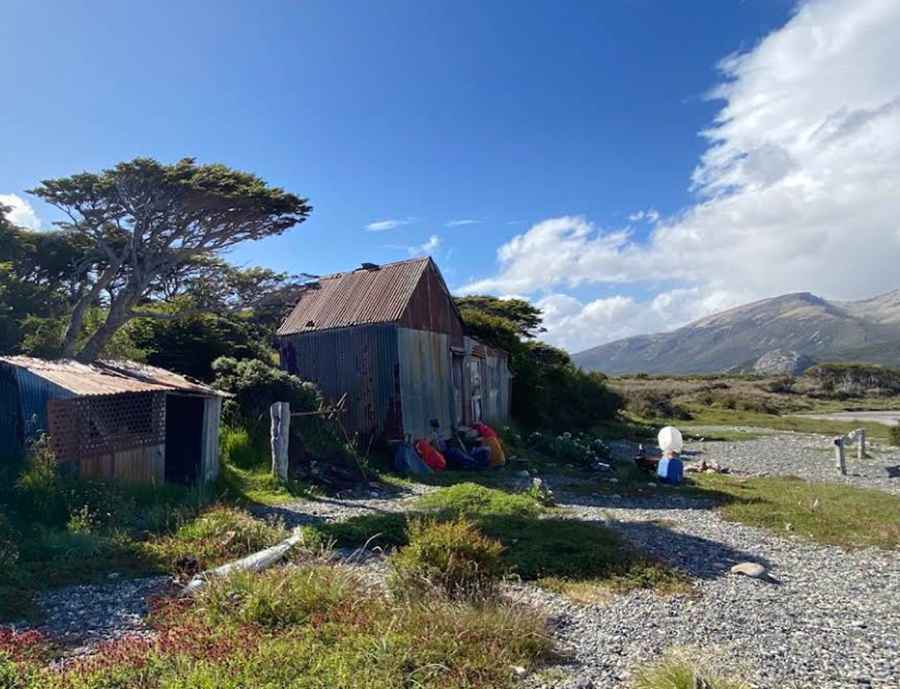
Destacamento Policial de Bahía Sloggett is an abandoned police outpost located in Sloggett Bay (also historically spelled Sluggett or Eslóguez) in southern Argentina. Sitting at 55° 00' S, its rugged coastal access route is arguably the southernmost 4x4 track in the world.
Where is Destacamento Policial de Bahía Sloggett?
The outpost is situated on the isolated Mitre Peninsula (Península Mitre), in the southeastern corner of Isla Grande de Tierra del Fuego. Administratively, it belongs to the Ushuaia Department in Tierra del Fuego Province, roughly 2,400 km (1,491 mi) south of Buenos Aires.
How to get to Destacamento Policial de Bahía Sloggett?
Starting from the eastern terminus of Ruta Provincial J (at the Estancia Moat / Moat River area), a faint, extremely rough route is occasionally used by specially prepared 4x4 vehicles belonging to the Argentine police, the Navy, or extreme off-road expeditions. The route advances by fording unbridged rivers, crossing swampy peat bogs, and driving directly along the sand and pebble beaches at low tide until reaching the Sloggett Bay outpost—and slightly further south, the Cabo San Pío beacon (55° 03' S), the southernmost point of Isla Grande.
Is there a road to Destacamento Policial de Bahía Sloggett?
No. Unlike a paved road or a maintained gravel track, any tire ruts are constantly erased by the growth of peat moss, heavy rains, and coastal tides. Furthermore, the dense canopy of the sub-Antarctic forest (lenga and coihue trees) completely obscures any inland trace. Historically, routine crew rotations and resupply missions for the outpost were conducted by sea (via Navy or Coast Guard vessels) or by helicopter; today, the rusted corrugated-iron structures stand abandoned and serve only as an emergency shelter for occasional trekkers and expeditions.
How long is the access track to Destacamento Policial de Bahía Sloggett?
The route covers approximately 35–45 km (22–28 mi) from the end of Ruta Provincial J at the Moat River, with no laid-out road at all. Motorists must navigate treacherous peat bogs (turberas, where a standard vehicle will sink to its chassis in seconds), freezing river crossings such as the López River, dense woodland, and long coastal stretches along pebble and sand beaches—forcing drivers to carefully calculate Beagle Channel tide tables to avoid being trapped against the cliffs.
Can I drive my vehicle to Destacamento Policial de Bahía Sloggett?
This route is strictly suitable only for heavily modified 4x4 vehicles equipped with oversized mud-terrain tires, a snorkel, and a winch. Because recovery options are non-existent and there is no mobile phone signal, expeditions should only be attempted in a convoy of multiple vehicles capable of self-recovery.
Pic: laura andres