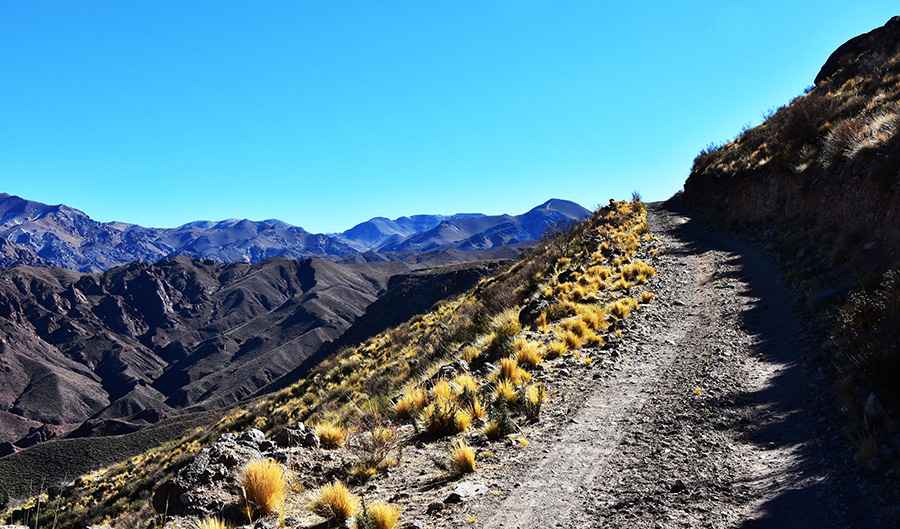
Driving the unpaved Cruze de Montanha to Paso de San Buenaventura
Paso de San Buenaventura is a high mountain pass at an elevation of 3,747m (12,293ft) above sea level, located in the Catamarca Province of Argentina. Crossing the rugged San Buenaventura mountain range, the road—known locally as Cruze de Montanha—is a remote high-altitude track that demands respect, mechanical preparation, and a capable 4x4 vehicle.
| Road facts: Paso de San Buenaventura | |
|---|---|
| Location | Catamarca Province, Argentina |
| Length | 24.8 km (15.4 miles) |
| Max Elevation | 3,747 m (12,293 ft) |
| Surface | Unpaved, sand, and loose gravel |
| Vehicle Required | High-clearance 4x4 with low range |
How challenging is the road to Paso de San Buenaventura?
The 24.8 km journey connects Las Papas with Ruta Provincial 34, running in a south-north direction. The track is entirely unpaved and sits in a state of natural decay. The surface is a mix of fine volcanic sand and loose gravel that can easily trap vehicles without sufficient traction. The climb is technical, featuring 8 sharp hairpin turns where the track narrows significantly against the mountain flanks. At over 3,700 meters, engine power drops noticeably, and maintaining momentum on the sandy inclines requires a steady foot and a low-range gearbox to avoid burying the tires in the soft terrain.
What are the primary hazards in the San Buenaventura range?
Isolation is the biggest threat on this route. Once you leave Las Papas, there is zero support, and you are unlikely to encounter other vehicles for days. The track is exposed to extreme winds and intense solar radiation during the day, followed by sub-zero temperatures at night. The loose nature of the ground means that after heavy rains or snowmelt, the road can wash out or become a mud trap. In the steeper sections, the lack of any shoulder or barrier leaves the driver with no margin for error, as the crumbling edges of the track offer little stability if you stray from the center of the path.
Is a 4x4 mandatory for this Argentine pass?
Attempting this pass in anything other than a high-clearance 4x4 is a mistake. The Cruze de Montanha road is not a standard mountain track; it is an expedition route. You will encounter deep ruts, sand pockets that can swallow standard tires, and rock-strewn sections that will punish a vehicle's undercarriage. It is essential to carry at least one full-sized spare tire, as the sharp volcanic rocks in this part of Catamarca are notorious for slicing through sidewalls. Before starting the climb, ensure your cooling system and air filters are at 100%, as the fine dust and steep gradients at altitude will put immense strain on the engine.
What is the best time to drive the Cruze de Montanha?
The window for a safe crossing is narrow. During the southern winter, the pass is often blocked by snow and extreme ice, making it totally inaccessible. The best months are typically from late spring to early autumn (November to March), but even then, you must be prepared for "viento blanco" (high-altitude blizzards) that can appear without warning. Logistics are key: carry enough fuel for twice the distance, as consumption in low range at high altitude is extreme. This is a journey for those who seek the rawest side of the Andes, where the goal is simply to keep the vehicle moving forward until you reach the connection with RP34.
Road suggested by: Hugh Wilson
Pic: Federico Lausi