Driving the extreme 4x4 mining road to Lastarria Volcano in the Andes
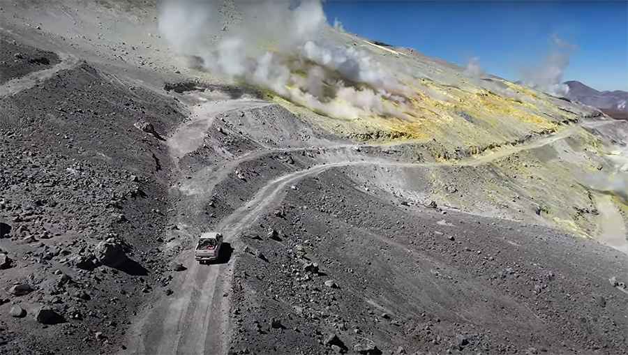
Volcán Lastarria (also known as Azufre) is an active stratovolcano reaching an elevation of 5,324 meters (17,467 ft) above sea level on the border between Antofagasta Region (Chile) and Catamarca Province (Argentina). The unpaved sulfur mining track on its flanks ranks among the highest roads of Chile, accessing high-altitude volcanic fields in the Atacama Desert.
| Road facts: Volcán Lastarria | |
|---|---|
| Location | Antofagasta (Chile) / Catamarca (Argentina) |
| Summit Track Elevation | 5,324 m (17,467 ft) |
| Nearest Inhabited Place | ~150 km (93 miles) away |
| Surface | Unpaved volcanic ash, loose scree, and sand drifts |
| Vehicle Requirement | High-clearance 4x4 mandatory |
| Key Hazards | 50% oxygen atmospheric power loss, volcanic sulfur gas emissions, deep sand drifts |
Where is the road to Volcán Lastarria located?
The track approaches the volcano from the Chilean side of the Atacama Desert, within the northern sector of the Lazufre volcanic complex. The unpaved route winds through abandoned sulfur extraction sites near the southwestern slopes of the peak.
Is the road to Volcán Lastarria unpaved?
Yes. The entire ascent is unpaved, consisting of fine volcanic ash, sharp obsidian scree, and uncompacted sand drifts. Wind constantly shifts the surface layer, covering sections of the track with sand or hard ice spikes (penitentes) during early spring.
What hazards exist when driving to Volcán Lastarria?
The main physical hazards are heavy atmospheric oxygen loss that degrades engine torque at 5,324 meters, active fumaroles emitting toxic sulfur gas along the upper track, and zero roadside assistance within a 150-kilometer radius. Driving requires a high-clearance 4x4 vehicle to negotiate deep ash ruts and steep volcanic gravel ramps.
Road suggested by: Hugh Wilson
Pic&video: YUKOPILOT