How to drive to Cerro Morado in Salta?
Cerro Morado is a high mountain pass at an elevation of 4,726 m (15,505 ft) above sea level, located in the Santa Victoria department of Argentina. It's one of the highest roads in the country.
Where is Cerro Morado?
The pass, known as Abra Ciénega on some maps, is located north of the iconic Abra Fundición, in Salta province, near Jujuy province, in the northern part of the country.
Is the road to Cerro Morado unpaved?
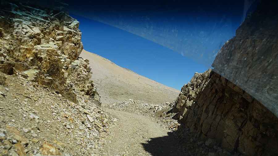
The pass road is fully unpaved, requiring vehicles with high clearance and preferably 4x4, especially after rain. Driving here is very dangerous. The road is too tight for two regular cars to pass comfortably, and steep drops beside the road become more threatening with other traffic. You can't afford errors, and the weather often turns extreme. The high elevation, chance of altitude sickness, changing weather, steepness, and difficulty in reaching it all make this pass unsafe and the summit drive tough.
How long is the road to Cerro Morado?
Starting from Paltoroa, the road to the summit is 17.86 km (11.1 miles) long. Over this distance, the elevation gain is 932 m (3,058 ft) and the average gradient is 5.21%. The road is surrounded by colorful mountains and eroded rock walls.
Road suggested by: Hugh Wilson
Pic: Vicky Yened