The challenging 4x4 road to Cerro Tuc Tuc: A high-altitude pass in Salta
Cerro Tuc Tuc is a high mountain pass reaching an elevation of 4,624m (15,170ft) above sea level, located in the Santa Victoria Department of Salta, Argentina. This remote track, also known as Cerro Tuc Tuca, is one of the highest roads in the country and offers a raw driving experience near the border with Jujuy.
| Road facts: Cerro Tuc Tuc | |
|---|---|
| Location | Salta Province, Argentina |
| Length | 18.66 km (11.6 miles) |
| Elevation Gain | 624 m (2,048 ft) |
| Average Gradient | 3.34% |
| Surface | Unpaved (Gravel/Dirt) |
| Hazard Level | High (Altitude & Narrow pass) |
Where is the road to Cerro Tuc Tuc located?
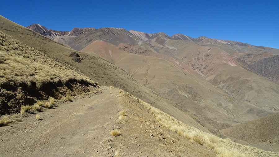
The pass is situated to the west of the iconic Abra Fundición in northern Argentina. The road, locally known as Camino a Bacoya, winds through a dramatic landscape of colorful mountains and eroded rock walls typical of the high Andean plateau.
Is the road to Cerro Tuc Tuc paved?
No, the road through the pass is entirely unpaved. It consists of a narrow dirt and gravel track that requires a high-clearance vehicle. Driving this road is technical, as the path is often too narrow for two regular cars to pass each other easily, especially in areas with dangerous drop-offs.
How long is the ascent to Cerro Tuc Tuc?
Starting from Santa Cruz de Aguilar, the road to the summit is 18.66 km (11.6 miles) long. The route involves a steady climb with an elevation gain of 624 meters. While the average gradient is a moderate 3.34%, the high altitude makes the drive demanding for any engine.
Is a 4x4 vehicle required for Cerro Tuc Tuc?
Yes, a 4x4 vehicle is highly recommended, especially after it rains. The surface can become slippery and the steep hills require excellent traction. This is a remote area where help is far away, so being equipped with a proper off-road vehicle is essential for a safe journey.
What are the driving conditions at Cerro Tuc Tuc?
The weather at 4,624 meters is often extreme and changes rapidly. Drivers must be prepared for the notorious absence of oxygen and the risk of altitude sickness (AMS). The combination of steep hills, narrow passages, and changing weather makes driving to the summit a challenge that requires total focus.
What can you see from the summit of Cerro Tuc Tuc?
The pass offers breathtaking panoramic views of the Salta and Jujuy highlands. The surrounding colorful mountains create a unique visual experience, making it a favorite spot for overlanders looking for the most isolated and scenic roads in northern Argentina.
Road suggested by: Hugh Wilson
Pic: Vicky Yened