A memorable unpaved road to Abra de Chorrillos
Abra de Chorrillos is a high mountain pass at an elevation of 4.555m (14,944ft) above sea level, located in Argentina. It's one of the highest roads in Argentina.
Where is Abra de Chorrillos?
The pass, also known as Abra de Alto Chorrillos and Alto Chorrillo, is located on the boundary between Jujuy and Salta provinces, in the northwestern part of the country. The climate is arid and cold: high temperatures vary little (since the warmer season is cloudy, and the coolest is sunny), ranging from 14°C to 21°C (57F to 70F), night temperatures go from 6°C (43F) in midsummer to -8°C (18F) in midwinter, and extremes under -15°C (5F) might be recorded. All rain falls exclusively in the summer, with values between 200 mm and 400 mm in total. Several salt flats exist in this area.
Can I drive a 2wd vehicle through Abra de Chorrillos?
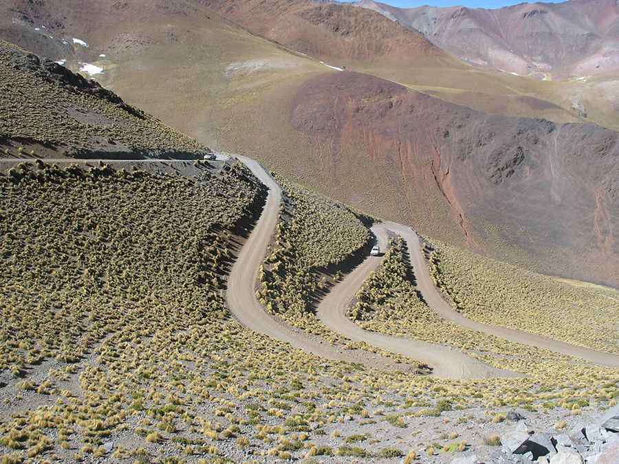
The curvy road to the summit is totally unpaved but navigable by all passenger vehicles, in dry weather. It’s called Ruta Nacional 51 (RN51). Much of the time, the road runs alongside the now-disused old railway.
How long is Abra de Chorrillos?
The pass is 57.9 km (35.97 miles) long, running east-west from San Antonio de los Cobres (the capital of the Los Andes Department of the Salta Province) to Olacapato (in Salta Province and one of the highest towns in the country).
Pic: stephuvey