Abra de Ovejería: Driving the unpaved 4,310m track in Salta
Abra de Ovejería is a high mountain pass at an elevation of 4,310 meters (14,140 ft) above sea level, located in the Rosario de Lerma Department, Salta Province, Argentina. The route is an unpaved track that crosses the eastern range of the Andes.
| Road facts: Abra de Ovejería | |
|---|---|
| Location | Rosario de Lerma, Salta, Argentina |
| Elevation | 4,310 m (14,140 ft) |
| Length | 85.7 km (53.2 miles) |
| Surface | Unpaved / Sand, Gravel & Calamina |
How long is the road to Abra de Ovejería?
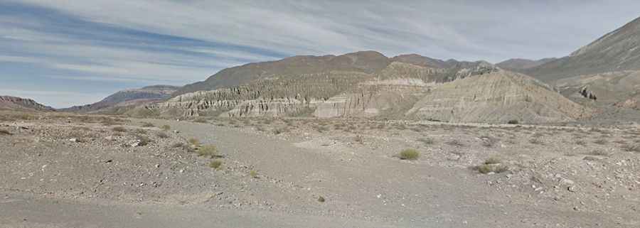
The unpaved track is 85.7 kilometers (53.2 miles) long, connecting the paved Ruta Nacional 51 near El Alfarcito with the valley of San Lorenzo. The alignment climbs from the Puna plateau up to the summit at 4,310 meters before descending the eastern slopes. The track lacks mobile phone coverage along the entire mountain segment.
What are the road conditions on the Abra de Ovejería track?
The surface is completely unpaved, alternating between loose gravel, volcanic dust, and deep sand pockets in the dry riverbeds. Long sectors present corrugated surfaces, known locally as calamina, which cause high vehicle vibration. The track is single-lane wide with natural earth shoulders and vertical drop-offs that lack steel guardrails or concrete walls.
What are the driving hazards at Abra de Ovejería?
At 4,310 meters altitude, thin air decreases engine torque by approximately 40% in naturally aspirated motors. Wind and water erosion carve ruts across the soil layers, exposing sharp Andean stones that puncture tire sidewalls. Low gear ratios are required to maintain traction on the sandy ramps and to provide engine braking during the descent toward San Lorenzo.
When is Abra de Ovejería closed?
Between December and March, the summer monsoon causes flash floods that wash away parts of the dirt track and fill the crossings with mud. From May to September, winter snowstorms and ice sheets block the pass at the 4,310-meter summit. Vehicles must carry 40 liters of auxiliary fuel, 20 liters of water, a mechanical shovel, sand tracks, and a full-size spare tire before leaving the RN51 junction.