What are the most spectacular roads in Argentina?
Located in South America, Argentina is a country of contrasts, and so are the roads. It features more than 100 roads listed as the most spectacular in the world, including climbs to mountain peaks, mountain passes and coastal drives. A challenge for everybody.
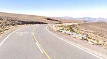
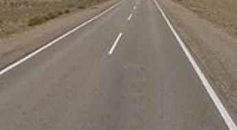
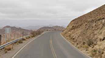
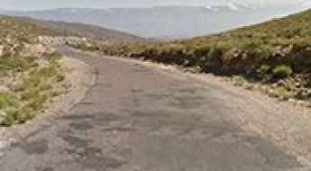
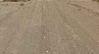
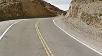
For instance, the country hosts a never-ending list of mountain passes acting as borders with other countries. It’s worth to remember the country shares borders with Chile, Bolivia, Paraguay, Brazil and Uruguay. If you travel to Argentina, you can’t miss the legendary Route 40. Stretching from Santa Cruz Province in the south to Jujuy Province in the north, Ruta 40 is a real adventure in the western part of Argentina. It’s one of the longest and most spectacular drives in the world. Remember the climate ranges from subtropical in the north to subpolar in the south, so plan accordingly the drive.
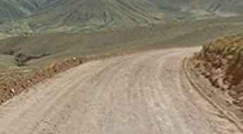
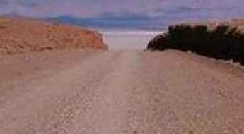
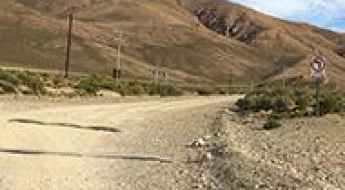
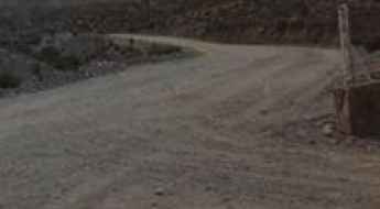
If you prefer mountain roads, you can’t avoid Jama Pass, an Andean road from Chile to Argentina at an elevation of 4,283m (14,051ft) above sea level; Roballos Pass, an Andean pass from Chile to Argentina at an elevation of 651m (2,135ft) above sea level; or driving the international San Francisco Pass in the Andes, a mountain pass at 4,760m (15,616ft) above sea level, on the border with Chile. It's one of the highest roads of Argentina. Or the popular Sico Pass, a scenic border pass in the Andes, at an elevation of 4.092m (13,425ft) above sea level, on the border of Chile and Argentina.
Driving the legendary Route 40 in Argentina: Road Trip Guide
Stretching from Santa Cruz Province in the south to Jujuy Province in the north, Ruta 40 is a real adventure in the western part of Argentina. It’s one of the longest and most spectacular drives in the world.
Jama Pass is an Andean road from Chile to Argentina
Paso de Jama is an international high mountain pass at an elevation of 4.283m (14,051ft) above sea level, located on the border of Chile and Argentina.
Roballos Pass is an Andean pass from Chile to Argentina
Paso Rodolfo Roballos is an international mountain pass at an elevation of 651m (2,135ft) above sea level, on the border between Chile and Argentina.
Driving the international San Francisco Pass in the Andes
Paso de San Francisco is an international high mountain pass at an elevation of 4.760m (15,616ft) above sea level, located on the border of Argentina and Chile. It's one of the highest roads of the country.
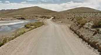
Driving the wild Cuesta del Lipán to Abra de Potrerillos in Jujuy
Abra de Potrerillos is a high mountain pass at an elevation of 4.192m (13,753ft) above sea level, located in the department of Tumbaya, in Argentina.
What are the highest roads in Argentina?
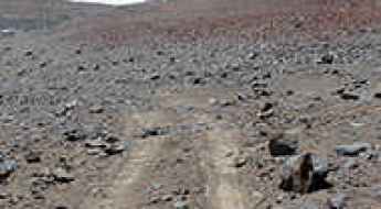
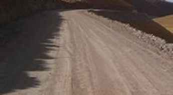
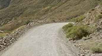
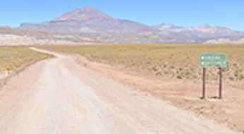
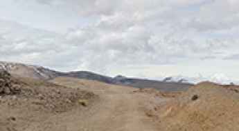
Located in southeastern South America, Argentina is the continent's second-largest country, defined geologically by the immense Andes Mountains that follow its western border for over 4,000 kilometers. This colossal mountain range contains Aconcagua—the highest peak in the Americas—and ensures that Argentina is home to some of the planet’s highest navigable roads. Many of these routes are rugged, unpaved tracks built for mining operations or remote border crossings with Chile, pushing into thin air above 4,700 meters (15,400 ft). This list documents the highest roads in Argentina, comprising a mix of challenging mountain passes and demanding high-altitude tracks.
A memorable unpaved road to Abra de Chorrillos
Abra de Chorrillos is a high mountain pass at an elevation of 4.555m (14,944ft) above sea level, located in Argentina. It's one of the highest roads in Argentina.
The narrow unpaved road to Iruya in Salta Province
Iruya is a small town at an elevation of 2.790m (9,153ft) above sea level, located in the Iruya Department of Salta Province in Argentina.
How to get to Gran Bajo de San Julián by car, the lowest point in the Americas?
Located in the eastern part of the province of Santa Cruz in Argentina, Gran Bajo de San Julián holds the distinction of being the lowest elevation in the Americas, sitting at -105 meters (-345 feet).
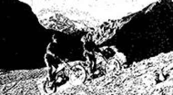
The Historic Motorcycle Expedition to Aconcagua with Bultaco Sherpa
Aconcagua is a high mountain peak at an elevation of 6.961m (22,838ft) above sea level, located in the Mendoza Province, Argentina. It’s one of the highest roads of South America.
Abra del Acay is said to be the highest road pass in America
Abra del Acay is a high mountain pass at an elevation of 4.956m (16,259ft) above sea level, located in La Poma Departament, in Salta Province, in Argentina. It’s said to be the highest road pass on a national highway in the whole of America.
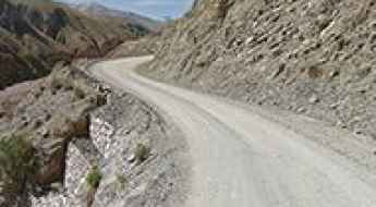
A Road through the Scenic Pircas Negras Pass High in the Andes
Paso de Pircas Negras (Black Pircas Pass) is an international high mountain pass at an elevation of 4.175m (13697ft) above sea level, located on the border of Argentina and Chile.
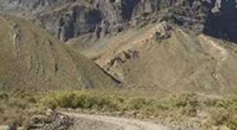
Driving the defiant Cuesta del Obispo to Piedra del Molino in Salta
Piedra del Molino is a high mountain pass at an elevation of 3,367m (11,046ft) above sea level, located in the central-western part of the province of Salta, in Argentina.
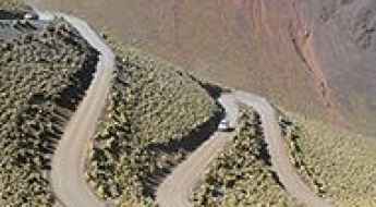
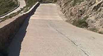
Driving the challenging 365 turns of Ruta del Año in the Andes
Ruta Provincial 52 is a challenging road located in the western part of Argentina near the Chilean border. It’s called Ruta del Año (Route of the Year) because it has 365 turns, most of them hairpins.
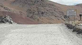
How to drive the perilous Abra Fundicion in Salta?
Abra Fundición is a high mountain pass at an elevation of 4.743m (15,561ft) above sea level, situated in the province of Salta, in Argentina. The road through the pass is extremely challenging and not suitable for those afraid of heights. It's one of the highest roads in Argentina.
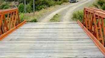
The challenging Puente Río Moat
Located in the southernmost tip of South America, in Argentina, the bridge over the Moat River is 42m long. It’s one of the most spectacular bridges in the world.
Travel guide to the top of Abra del Infiernillo
Abra del Infiernillo is a high mountain pass at an elevation of 3,056 m (10,026 ft) above sea level, located in Argentina. It’s the highest point on all the roads in Tucumán province.
Dare to drive the dangerous road to Abra del Condor
Abra del Cóndor is a high mountain pass at an elevation of 3.942m (12,933ft) above sea level located in Argentina.
How to Get by Car to Salar del Rincón in Los Andes?
Salar del Rincón is a salt lake at an elevation of 4,015m (13,172ft) above sea level, located in the Los Andes department of Argentina.
A Wild Road to Lagunillas del Farallon
Lagunillas del Farallón is a high mountain town at an elevation of 4,182m (13,720ft) above sea level, located in Jujuy, a province of Argentina.
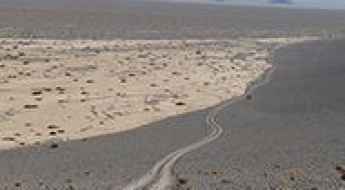
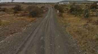
Driving through the straight Ruta Provincial 26 in La Pampa
Located in La Pampa province of Argentina, the unpaved Ruta Provincial 26 (RP26) is one of the longest straight roads in the world.
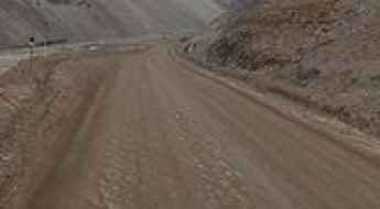
Ruta Provincial 70 is a road you'll never forget in Jujuy
Ruta Provincial 70 (RP70) is a high mountain dirt track located in the Jujuy province of Argentina.
A very bumpy, grueling road to Puna Jujeña
Puna Jujeña is a high mountain pass at an elevation of 4,438m (14,560ft) above sea level, located in the Rinconada Department of Argentina.
Cuesta del Farallon: Only Experienced Drivers with Advanced Off-Road Skills
Cuesta del Farallón is a high mountain pass at an elevation of 4,625m (15,173ft) above sea level, located in Jujuy Province in Argentina.
The unpaved road to El Aguilar, one of the highest towns in the world
El Aguilar is a small town and a mine located at an elevation of 4,895m (16,060ft) above sea level, in the Jujuy Province of Argentina. It’s one of the highest towns accessible by car on Earth.
The Wild Road to Cerro Galan in the Andes
Cerro Galán is a volcano at an elevation of 4,964m (16,286ft) above sea level, located in a remote part of the Catamarca Province of Argentina.
Driving the Scenic Camino 6 de Septiembre to Cerro Pan de Azúcar in Córdoba
Cerro Pan de Azúcar is a famous mountain pass reaching an elevation of 1,023m (3,356ft) above sea level in the Sierras Chicas of Córdoba, Argentina. The road over the pass, known as the Camino 6 de Septiembre, is a classic mountain route connecting the Punilla Valley with the Sierras Chicas.
Travel Guide to the Top of Abra del Gallo
Abra del Gallo is a high mountain pass at an elevation of 4,630m (15,190ft) above sea level, located in Salta Province, Argentina. It's one of the highest roads in the country.
Abra Blanca, the world's highest road in 1915
Abra Blanca is a high mountain pass at an elevation of 4,102m (13,458ft) above sea level, located in Salta Province, in Argentina.
The Inhumane Climb to Cerro El Amago with 19% Ramps
Cerro El Amago is a high mountain pass at an elevation of 1,703m (5,587ft) above sea level, located in San Luis Province in Argentina.
Road trip guide: Conquering Pascua Lama
Pascua Lama is an international high mountain peak at an elevation of 5,256m (17,244ft) above sea level, located on the border of Argentina and Chile. It's one of the highest roads in the country.
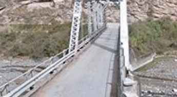
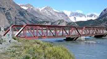
Puente Mal Paso: The Historic Icon of the Escoipe Gorge
Puente Mal Paso is a historic mountain bridge located in the province of Salta, in Northwest Argentina. Situated over the Escoipe River, this iconic structure serves as the dramatic gateway to the famous RP33, the road that leads travelers toward the Cuesta del Obispo and the Calchaquí Valleys. It’s one of the most spectacular bridges in the world.
A memorable road trip to Abra del Lizoite
Abra del Lizoite is a high mountain pass at an elevation of 4.536m (14,882ft) above sea level, located in Argentina. It's one of the highest roads in the country.
Driving the defiant Ruta Provincial A in the Province of Tierra del Fuego
Ruta Provincial A is a very scenic drive located in the Tierra del Fuego Province in Argentina, the southernmost extreme of the Americas.
Crossing the beautiful Puente del Rio Electrico
Located within the Los Glaciares National Park in Santa Cruz Province, of Argentina, Puente del Rio Electrico is a short wood bridge located on the road Ruta Provincial 23, near the Chilean border over the Electrico River. It’s one of the most spectacular bridges in the world.
Driving to Sosneado Hotel, a nazi hideout in Mendoza
Hotel Termas de El Sosneado is an abandoned hotel located in the Province of Mendoza, in Argentina. Locals say the hotel was supposedly a nazi hideout. The area is very remote.