Periodically Flooded Roads: Most Dangerous Tidal and Submerged Routes
Submerged roads and tidal causeways are vehicular routes constructed across intertidal flats, estuaries, river deltas, or floodplains that become completely covered by water at regular cycles. Driving these routes requires operating within strict low-tide time windows to avoid rapid water submergence, vehicle flotation, mud flat immobilization, and saltwater corrosion damage to engine components and undercarriages.
| Global Tidal & Submerged Road Facts | |
|---|---|
| Primary Hazards | Rapid tide surges, sea mud entrapment, vehicle buoyancy, vehicle loss |
| Surfaces | Saturated asphalt, wet cobbles, sandbars, marine algae, and mudflats |
| Submergence Frequency | Twice daily (semi-diurnal tides) to seasonal (monsoon/river floods) |
| Water Depth Range | 1.0 to 4.0+ meters at high tide |
| Traction Condition | Low friction (marine silt, wet sand, and algae coverage) |
How do tidal and seasonal cycles submerge these roads?
Tidal causeways are cut off twice every 24 hours by gravitational ocean tides, covering the road surface under 1 to 4 meters of saltwater within minutes. Inland flooded roads are submerged seasonally by monsoon rainfall, river surges, or meltwater, hiding road edges beneath turbid water currents where vehicles must rely on vertical marker poles or guide beacons to stay on the paved track.
Passage du Gois (France)
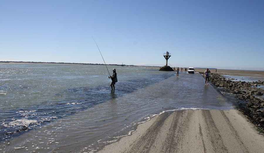
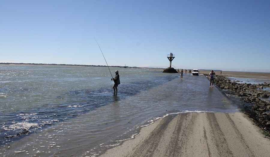
The Passage du Gois (also known as Gôa) is a 4,150-meter causeway connecting Noirmoutier Island to the mainland. A national monument in France, it is only accessible for 1.5 hours before and after the lowest tide. At high tide, the road sits under 1.5 to 4 meters of water, often trapping drivers who underestimate the Atlantic's speed.
Pic: Christophe Terrier
Shell Island Causeway (Wales)
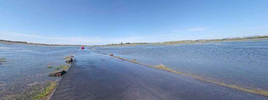
Located in Gwynedd, the Shell Island Causeway links the UK's largest campsite to the mainland across the River Artro estuary. The road disappears twice a day with the tides. While drain pipes help manage the flow, weather conditions frequently force closures, turning the peninsula back into a true island.
Pic: Dragon Tv
Lindisfarne Causeway (United Kingdom)
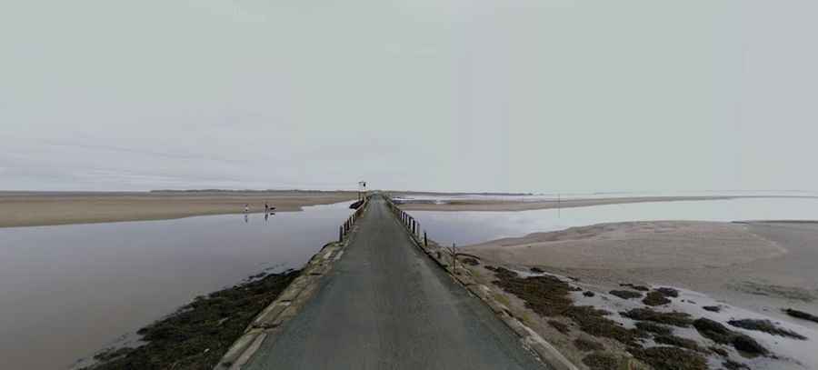
The Lindisfarne Causeway is the only paved link to Holy Island. Swallowed by the North Sea twice every 24 hours, it attracts over 650,000 annual visitors. It is famous for its elevated "refuge boxes," essential for travelers caught out by the rapid North Sea tide.
Låningsvejen (Denmark)
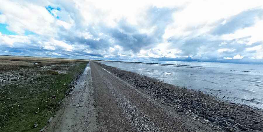
Deep in the Wadden Sea National Park, the island of Mandø is reached via Låningsvejen. This unpaved causeway is covered twice a day by the North Sea, maintaining Mandø as one of Denmark's most peaceful and isolated islands during high tide.
Pic: Peter Kristensen
The Broomway (United Kingdom)
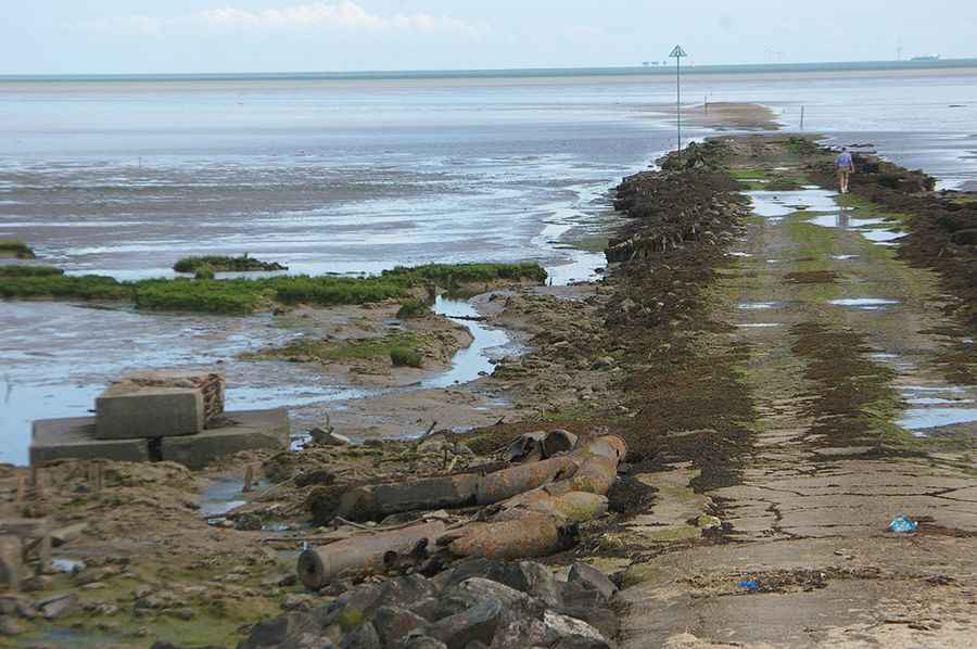
With a history of over 600 years and more than 100 recorded deaths, The Broomway in Essex is Britain’s deadliest path. It runs for 9.7 km (6 miles) across the Maplin Sands. The tide rushes over the flat mudflats with lethal speed, leaving no room for delay.
Pic: Norman Brice
Yongwu Road (China)
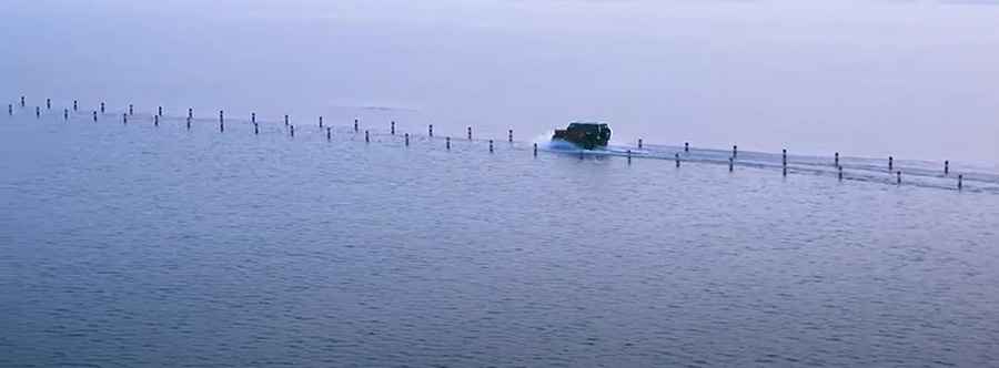
Built across Poyang Lake, Yongwu Road becomes a spectacular underwater highway during the rainy season. Drivers navigate by following the visible guard rails on either side until the water depth makes the asphalt completely impassable for months.
Pic: CCTV English
Osea Island Causeway (United Kingdom)
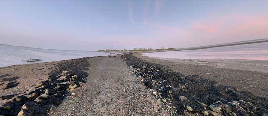
Considered Essex's greatest secret, the Osea Island Causeway is a 1.44 km (0.9 mile) unpaved track. Known locally as Osea Road, it is only accessible for about four hours a day at low tide in the River Blackwater estuary.
Pic: Will Collis
The Strood (United Kingdom)
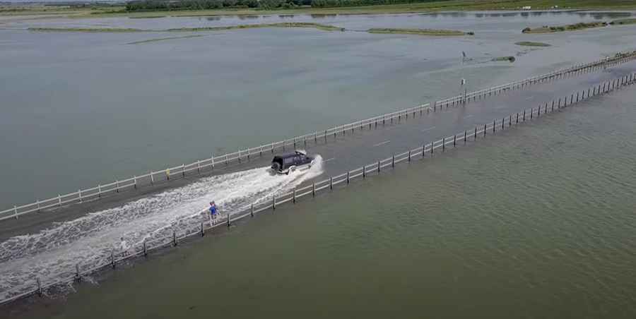
The Roman-origin The Strood is the only road to Mersea Island. This ancient B102 causeway is covered by the tide twice a day for about 90 minutes during spring tides, a link that has existed since 700 AD.
Pic: Just Harry Johnson
Welney Wash Road (United Kingdom)
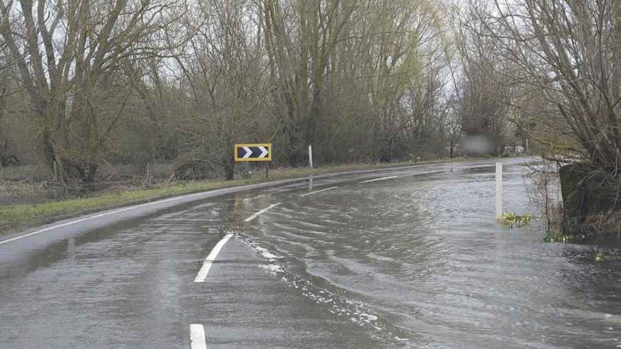
Unlike coastal roads, the Welney Wash Road crosses the Ouse Washes Flood Storage Reservoir. When water levels rise, the road is submerged and must be closed, frequently testing the patience of local drivers.
Napa Lake Highway (China)
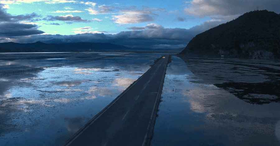
Tucked away in Yunnan Province, the Napa Lake Highway is a seasonal marvel. Every June, monsoon rains submerge this 12.5 km paved road, creating a drive where vehicles appear to be floating on the lake surface.
Horsey Island Causeway (United Kingdom)
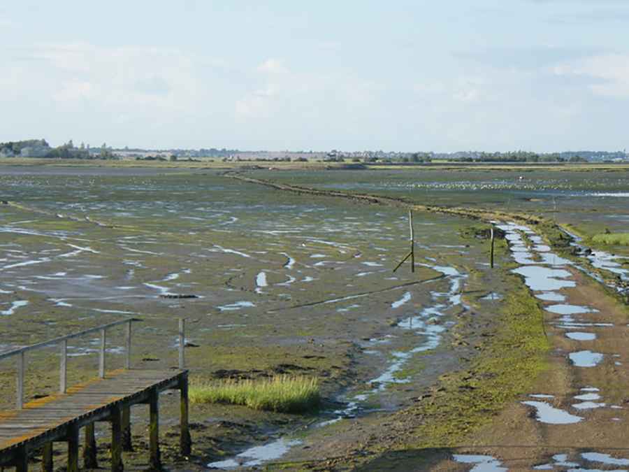
The Island Road to Horsey Island is an unpaved, periodically flooded causeway. This private route leads to an isolated 19th-century estate and is only passable at low tide through a protected natural area.
Pic: Ben Eagle
Omey Island (Ireland)
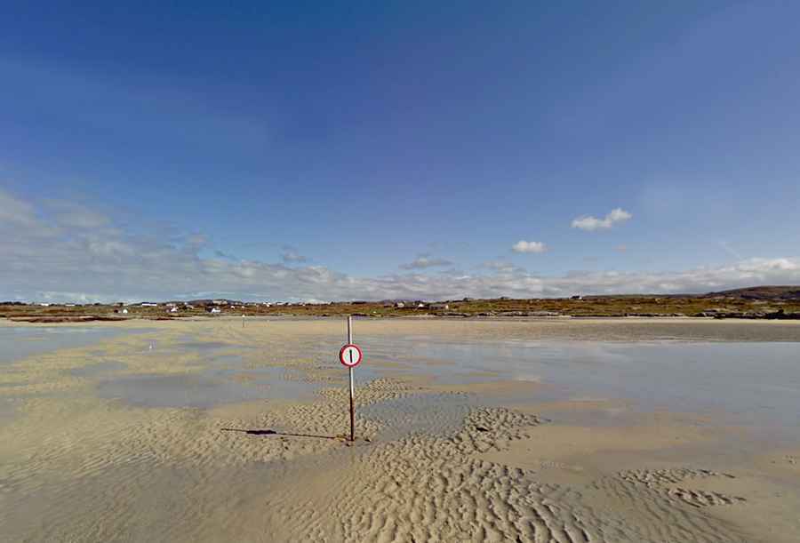
Off the coast of Connemara, Omey Island is accessible via a 700-meter sandy seabed road. Guided by markers in the sand, drivers navigate potholes and shifting conditions on this raw and stunning Connemara crossing.
Coney Island Tidal Road (Ireland)
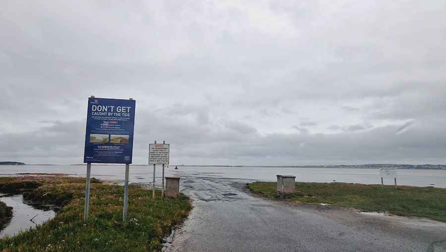
The Coney Island Drive in Sligo is a 2.8 km crossing over the Cummeen Strand. Drivers must strictly follow 14 historic stone pillars to avoid the soft mud flats and the unforgiving Atlantic tide.
Pic: Sunny 4444
Ministers Island (Canada)
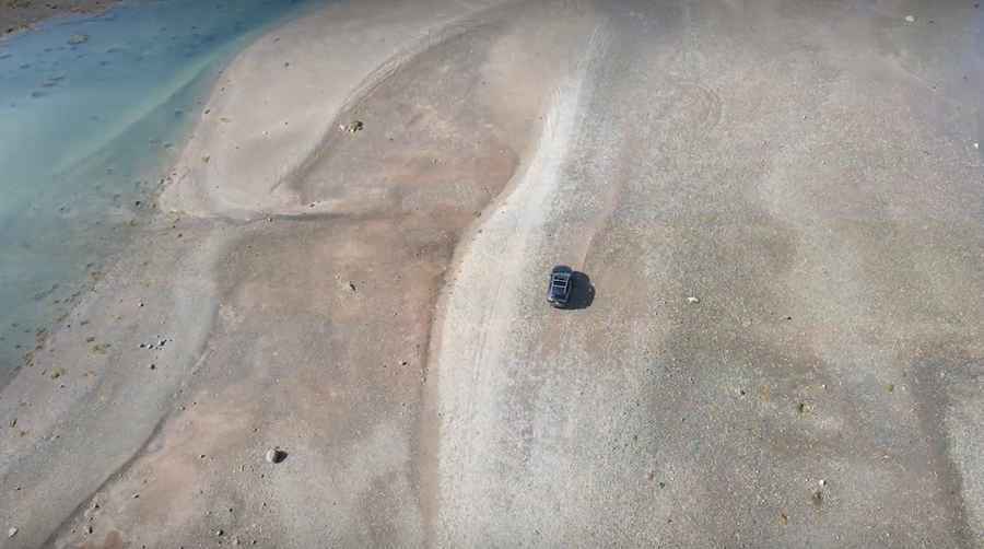
Access to Ministers Island in the Bay of Fundy is via the Bar Road. This natural causeway disappears under 4 meters of water twice a day, creating a high-stakes race against the world's highest tides.
Pic: https://www.ministersisland.net/
Ferry Road
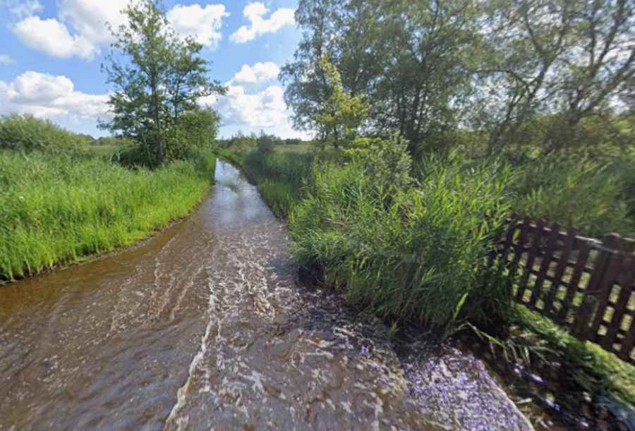
Ferry Road is a narrow single-lane track in the Woodbastwick Marshes, Norfolk, leading to the Horning foot ferry. It lacks regular maintenance and sits at water-table level, causing the River Bure to submerge a half-mile stretch under 3 to 10 inches of water during spring tides. Driving the concrete base requires avoiding hidden potholes and immediate fresh water flushes to counter brackish water corrosion.
Bar Island Land Bridge
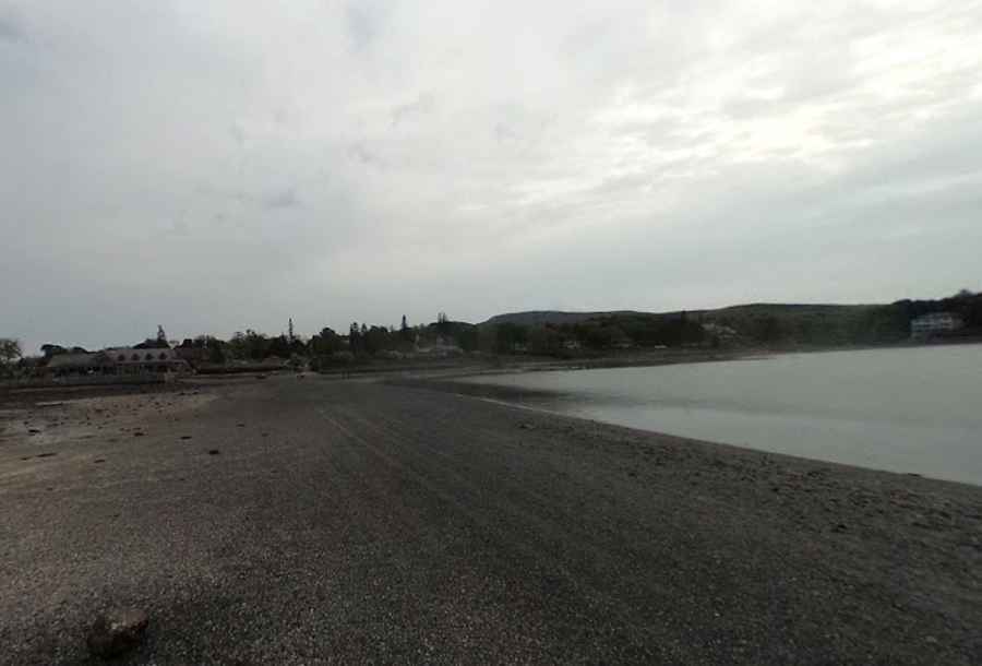
The Bar Island Land Bridge in Maine is a 1.2 km tidal causeway of wet gravel and mud that emerges only around low tide. Drivers have a strict 3-hour access window before the incoming Atlantic tide rises up to 3.6 meters, completely submerging the route and trapping stranded vehicles.
Pic: Plymouth Ansbergs (RainGoth)