Snow Mountain in Grant County: Driving the NF-215 to the Lookout
Reaching an elevation of 2,184m (7,165ft) above sea level, Snow Mountain in Grant County is a high mountain summit in the central part of Oregon. Located north of Riley, the peak sits on the boundary of the Ochoco and Malheur National Forests, serving as a critical point for fire surveillance in the region.
| Road facts: Snow Mountain (Grant County, OR) | |
|---|---|
| Location | Grant County, Oregon, USA |
| Elevation | 2,184 m (7,165 ft) |
| Road Name | NF-215 (from NF-43) |
| Length | 11.0 km (6.8 miles) |
| Avg Gradient | 5.47% |
How to reach Snow Mountain in Grant County by car?
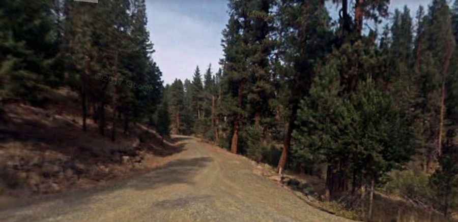
The ascent to the summit begins at the junction with the NF-43 road. From this point, the route to the peak follows the NF-215 forest road for 11.0 km (6.8 miles). The road is entirely unpaved and crosses sections of open rangeland and alpine forest. With a total elevation gain of 602 meters, the climb maintains a sustained average gradient of 5.47%. While the incline is manageable, the road surface consists of dirt and volcanic gravel, which can be slippery when wet.
Is the road to Snow Mountain in Grant County unpaved?
The NF-215 is a typical forest service road that is not maintained for standard passenger cars. A 4x4 vehicle is highly recommended due to the potential for deep ruts, washboard sections, and fallen debris from the surrounding forest. During the winter and early spring, the road is impassable due to deep snow accumulation. In summer, the dry surface can become very dusty, reducing visibility. Drivers should be alert for logging trucks and fire service vehicles that frequently use these forest corridors.
What is at the summit of Snow Mountain in Grant County?
The summit houses an active fire lookout tower, a 14’x14’ R-6 flattop structure with a catwalk mounted on a 10’ treated timber tower. The current building dates from 1961 and remains staffed every summer due to the high fire activity in the Ochoco and Malheur National Forests. This structure replaced several previous lookouts, including a 1915 ground cab and a 1930 L-4 house, marking over a century of continuous surveillance from this 2,184m vantage point.
What are the main hazards on the NF-215 road?
The primary hazards on the road to Snow Mountain in Grant County include steep embankments and narrow passing points. The 11 km climb lacks safety barriers, and certain turns require caution to avoid soft shoulders. Additionally, the area is prone to sudden summer thunderstorms; lightning is a significant risk at the summit, and rain can quickly turn the dirt NF-215 into a mud trap. Ensure your vehicle has a full-size spare tire and sufficient fuel, as there are no services or mobile coverage within the national forest boundaries.