How to drive the paved Lewis and Clark Highway in Washington?
The Lewis and Clark Highway is a very scenic drive located along the southern border of the US state of Washington. Following the route of Washington State Route 14 (SR-14), the road is fully paved and provides vast vistas along the Columbia River.
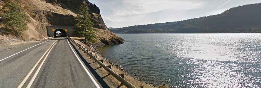
| Road facts: Lewis and Clark Highway (SR-14) | |
|---|---|
| Location | Clark, Skamania, Klickitat, and Benton Counties, Washington (USA) |
| Road Designation | State Route 14 (SR-14) |
| Length | 180 miles (290 km) |
| Surface | 100% paved asphalt |
| Route Termini | I-5 in Vancouver to I-82 near Plymouth |
| Key Hazards | Unlit rock tunnels, narrow two-lane sections, high crosswinds, rockfalls |
Where is the Lewis and Clark Highway located?
The highway is located in southern Washington, running along the Washington side of the Columbia River. The route traverses Clark, Skamania, Klickitat, and Benton counties, following the natural border with Oregon through the Columbia River Gorge.
How long is the Lewis and Clark Highway?
Spanning 180 miles (290 km), it runs from I-5 in Vancouver, Washington, to I-82 near Plymouth, running parallel to the Oregon border.
Is the Lewis and Clark Highway paved?
Yes. The road is fully paved along its entire length. It serves as an official state scenic byway and is a delight to drive, featuring every kind of twist and turn with numerous pullouts to stop for scenic vistas.
When was the Lewis and Clark Highway built?
The first highway through this area was completed in 1915. The modern route follows the historical corridor used during the Lewis & Clark expedition.
What are the main driving hazards on SR-14?
While the drive is generally leisurely, the road narrows to two lanes through several technical sections, cutting through five unlit rock tunnels carved into basalt cliffs. Heavy crosswinds through the gorge, potential rockfalls from adjacent cliffs, and heavy weekend traffic during peak holiday seasons are the primary hazards.