How to drive the unpaved road to Carter Peak in Utah?
Carter Peak is a high mountain peak at an elevation of 2.036m (6,679ft) above sea level, located in north-central Sevier County, in the US state of Utah. The rocky, single-lane dirt track with sheer drop-offs to the summit is brutal: 15.04% average gradient.
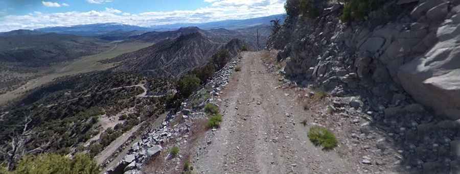
Where is Carter Peak?
The peak is located south of Salina, in the central part of Utah, within the Fishlake National Forest.
Why is there a road to Carter Peak?
At the summit there’s a radio tower, with 360-degree views of the entire Sevier Valley.
Is the road to Carter Peak unpaved?
The road to the summit is totally unpaved. It's a narrow, single-lane shelf road carved into a rocky cliffside, featuring a loose dirt and rock surface with steep, unprotected drop-offs. 4wd vehicle with high clearance required. It’s is impassable to vehicles the last couple hundred feet. The drive is very steep and features 10 hairpin turns. It’s best not to be scared of switchbacks or dug way as this trail is not for the faint of heart.
How long is the road to Carter Peak?
Starting from Sage Flat Road, the ascent is 2.24 km (1.39 mi) long. Over this distance the elevation gain is 337 meters. The average gradient is 15.04%.
Is the road to Carter Peak open year-round?
Set high in the Pavant Range, the road is usually open year-round, but short-time closures in winters are common. During the spring thaw or after heavy storms, the road surface becomes very muddy with deep ruts caused by running water.
Pic: Jeremy Peterson